I've been meaning to post a couple of stories about Bosnia and Serbia for a while now. Finally got around to it!
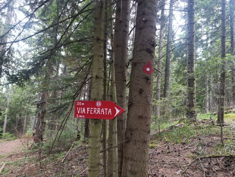
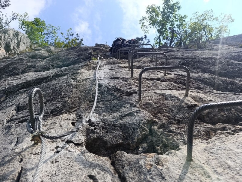
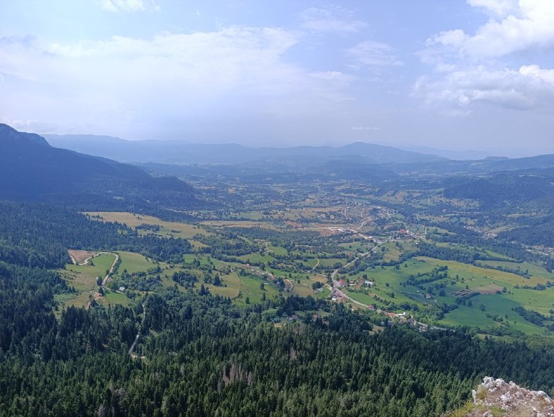
Not far from Sarajevo, there's a
via ferrata. I'd been planning to do it for a couple of years and finally made it happen!
Via ferrata literally translates from Italian as "iron path." They've been used in the Alps for centuries, and by the end of the 20th century, they spread around the world as a tourist attraction.
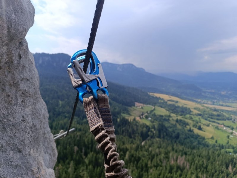
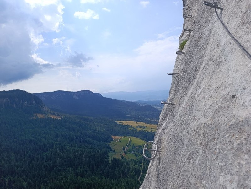
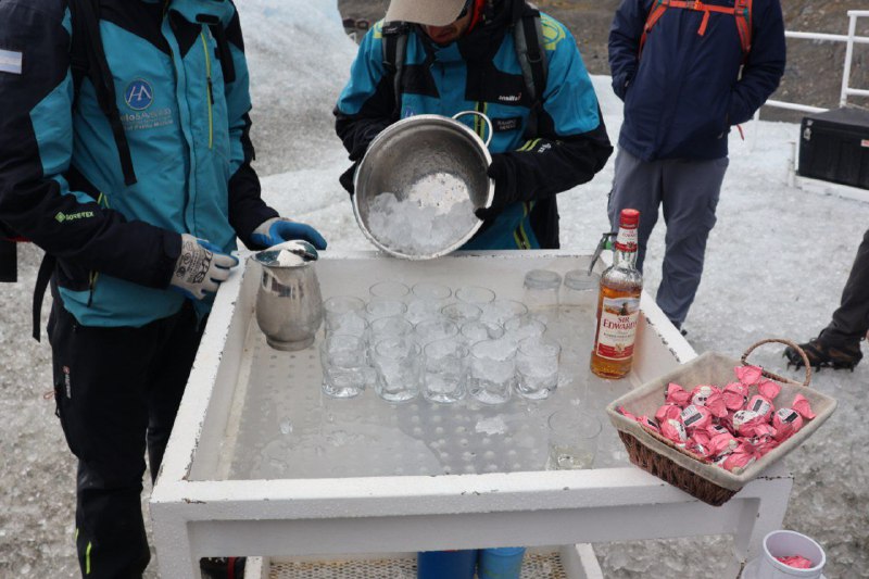
Basically, it's metal brackets hammered into the rock that you use to move along. You don't need climbing experience for easier routes. But you definitely shouldn't go without proper safety gear, and if you have no experience, definitely get a guide. On the Balkans, there's a sports community at every via ferrata where you can find a guide. In this case,
these guys. The guide costs money, but they only charged me 30 euros with full safety equipment. If you're not afraid of heights, I'd highly recommend it.
Overall, the trails to the ferrata are pretty clean, but there were empty bottles lying around in a couple of spots and the guide picked them up and took them with him. The Balkans can get pretty trashy in places like this. But these folks actually take care of it.
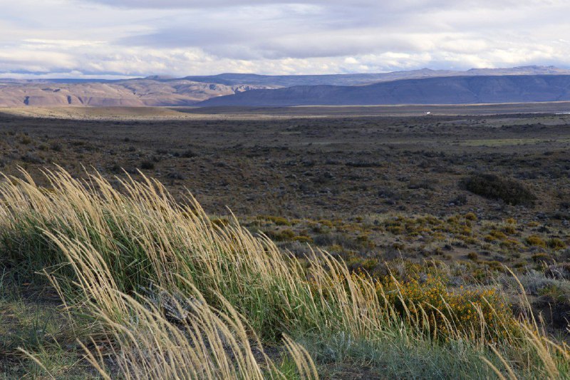
Just a short drive from the Andes, and you hit endless steppe. With incredibly strong winds. The rental office gave us an instruction manual with the car warning not to drive faster than 100 km/h in bad weather, because you can easily lose control. According to them, headwinds often exceed the car's speed. During strong gusts, the handling really was pretty sketchy.
The drone doesn't handle this kind of weather very well either. On one flight back, it couldn't make it. Had to walk out on foot to retrieve it. Plus, the camera's internal stabilizer clearly didn't do its job perfectly.
//
YouTubeCompared to the
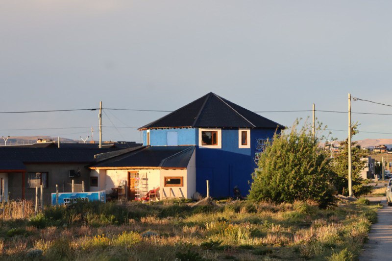
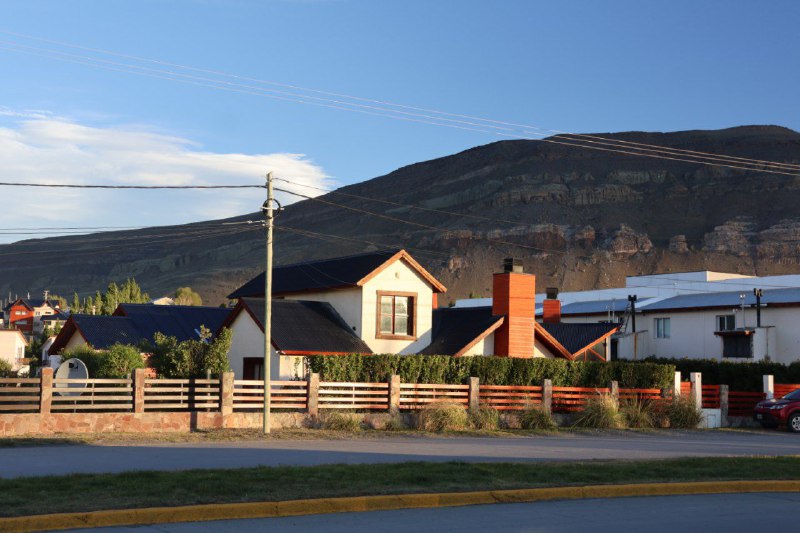
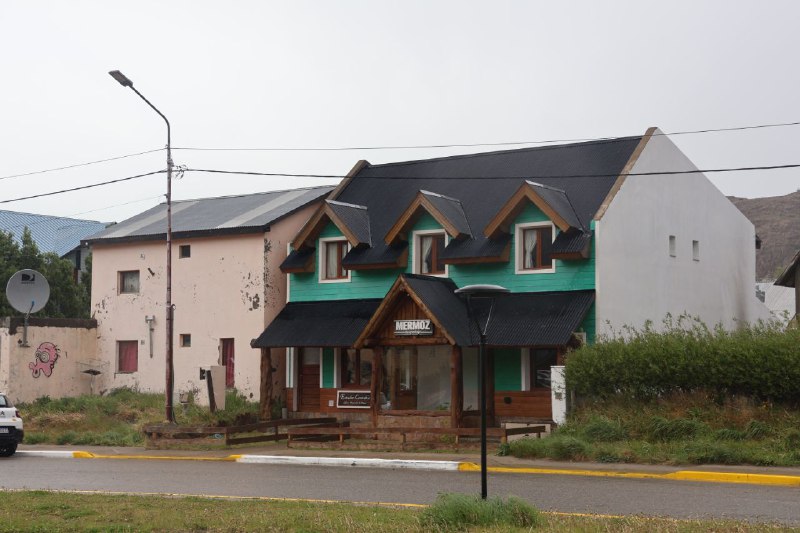
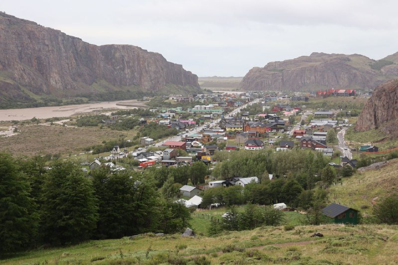
north, Argentina's southern towns look very... well, northern. There's something Nordic about it all. Reminds me of Sweden :)
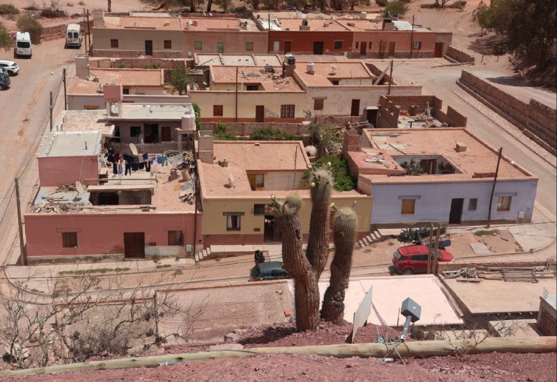
Back at the start of the 20th century, these areas weren't really settled. The climate here isn't great for living. These days people only live here to make money off tourists.
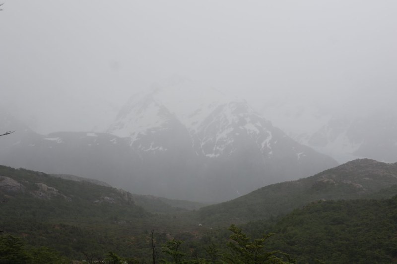
I was planning to do some hiking in El Chaltén (and it's not for nothing that it's considered the hiking capital of Argentina), but honestly didn't see much of anything. There's supposed to be a massive mountain in the second-to-last photo, but it just vanished into thick fog. Guess I'll have to go back again.
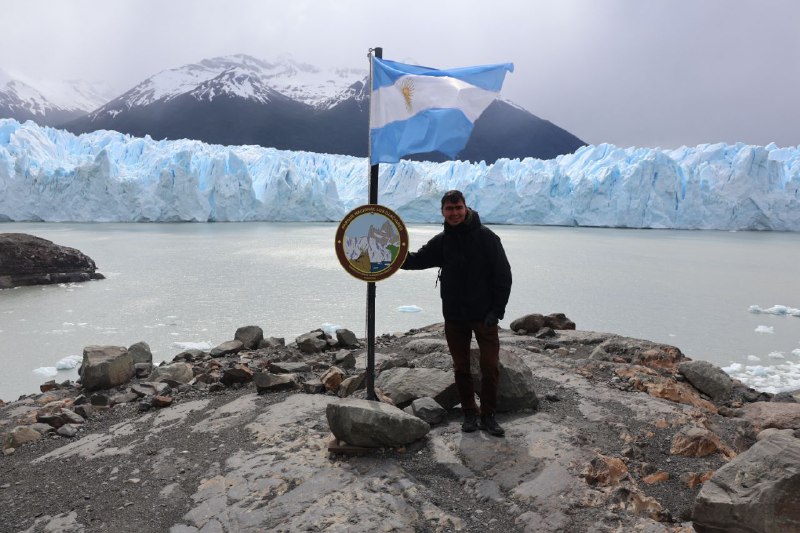
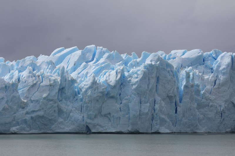
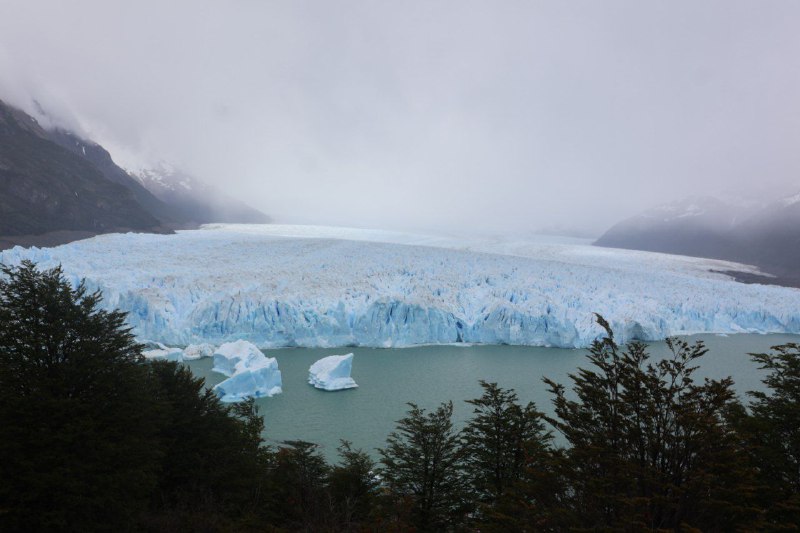
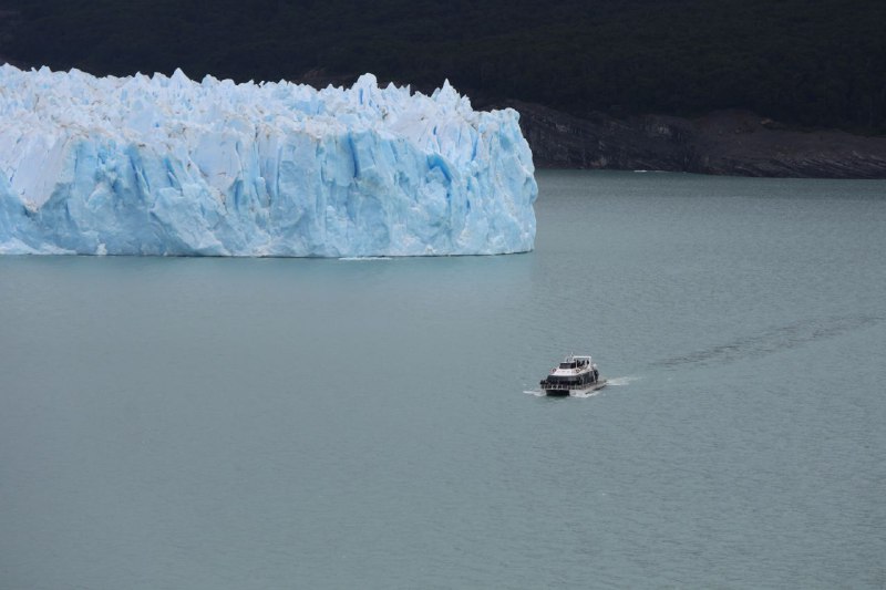
While the north of Argentina is scorching hot, the south is not just cool—it's literally a glacier. Perito Moreno. Even though it's a pleasant +15°C outside, the massive chunk of snow and ice doesn't fully melt. The photo only shows the upper part. There's even more ice underwater, and it reaches all the way to the bottom.
The glacier has completely blocked the lake several times. This caused flooding on nearby farms. In 1939, the military even bombed the glacier hoping to unblock the lake, but it didn't work. Eventually, a few months later, the ice retreated and water levels returned to normal.
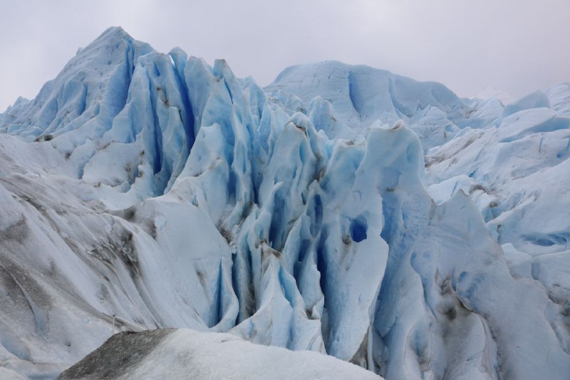
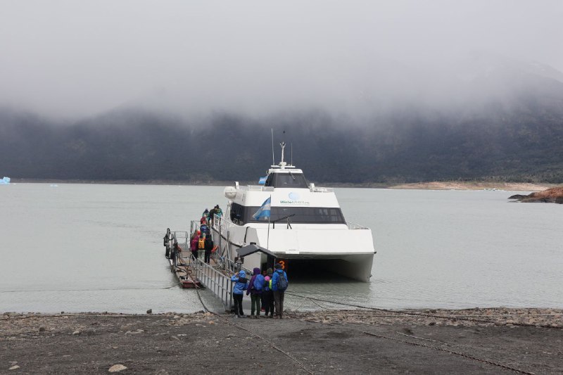
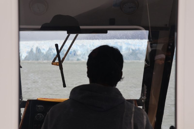
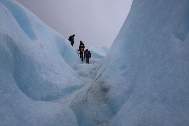
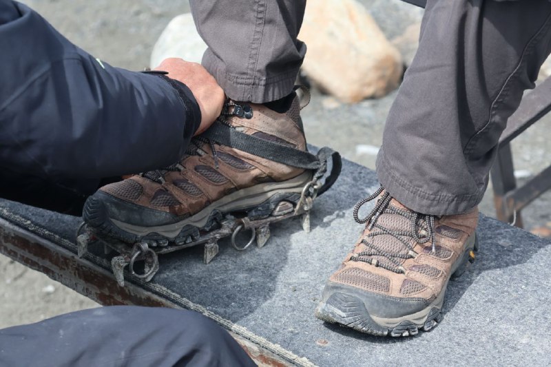
This is one of the most accessible glaciers in the world. For a reasonable amount of money, you can walk on it. They'll bring you by ferry, give you a guide, crampons, and explain how to walk properly. You can't go far—they only take you along the edge. For a hike several kilometers deep, they charge a lot more. I chickened out, even though I really wanted to do it.
The guide told me that in recent years the glacier has melted significantly, and the current edge is dozens of meters short of where it was a decade ago. It doesn't look like this trend will change anytime soon.
While traveling between towns, they show you things like this.
Thanks to the
track from the video (it's really cool), I learned about a South American beverage called
chicha with a very peculiar way of making it:
Women chew bread made from cornmeal, saturating it with saliva. Thanks to the enzymes present in saliva, starch is converted into sugar, which promotes fermentation. The alcohol content in chicha ranges from 1 to 6 percent, depending on whether the drink is being made for everyday use or for solemn religious festivals, such as Inti Raymi.
I'm not sure I'd want to try something like that.
//
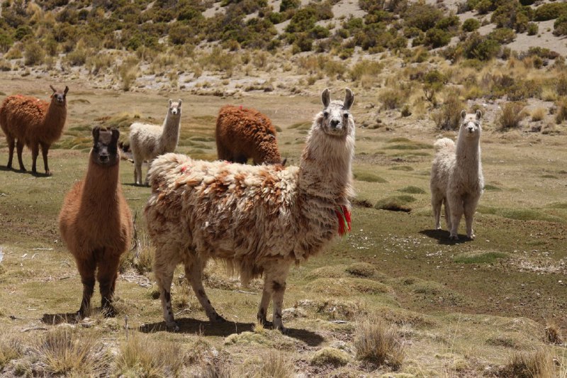
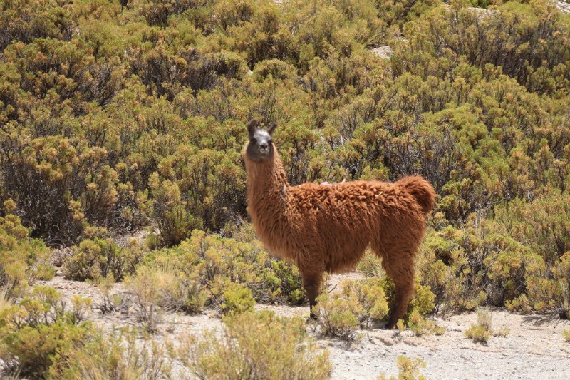
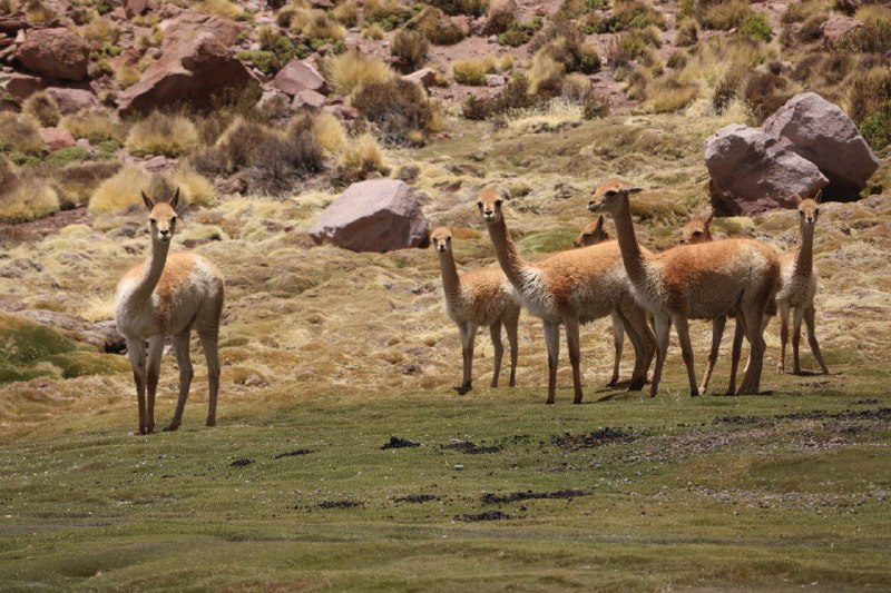
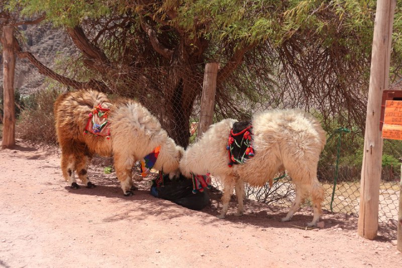
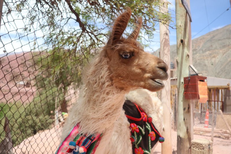
youtubeYou're driving down Argentina's Route 40 and you keep running into llamas, alpacas, and all kinds of vicuñas. I'm not really great at telling them apart. But they all look amazing :)
Above 3000 meters, the winds were so strong that the drone kept getting blown off course, the camera stabilizer couldn't keep up, and once we couldn't even make it back to the launch site because the wind picked up and exceeded the motors' capabilities. We had to land it wherever we could and hike over to pick it up. The views are still absolutely stunning :)
//
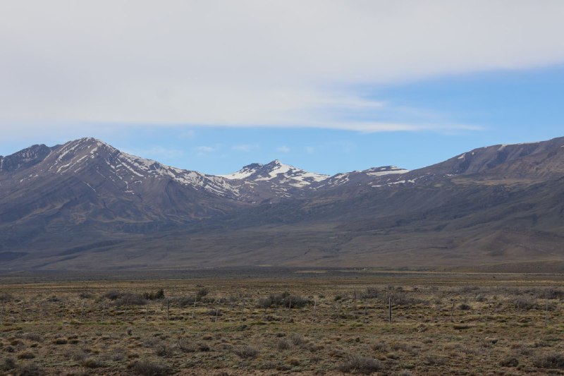
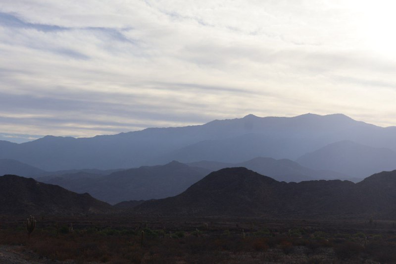
youtubeArgentina's Route 40 runs along the Andes and gets incredibly high in some spots. One point sits at almost 5,000 meters above sea level! You literally drive straight up to it. You're just a hair's breadth away from hitting that exact altitude mark, but if you walk a bit, you can actually get there. The problem is, after just 200 meters of walking, you're hit with brutal shortness of breath. It's like you've been smoking a pack of cigarettes every single day of your life and then suddenly sprinted a couple kilometers. I wasn't planning any serious hikes, but even this little walk was tough. Even the car starts performing noticeably worse at that altitude.
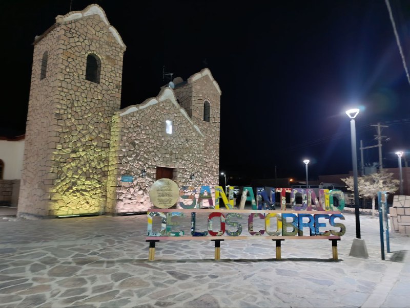
I spent the night in the town of San Antonio de los Cobres at 3,800 meters. That's noticeably lower than 5,000 meters, but even there, after a fifteen-minute walk before dinner, breathing was difficult. And don't even get me started on the night—I was sleeping loudly and desperately sucking in air the whole time because there just wasn't enough oxygen. By morning it got a bit easier, my body started adjusting, but you'd need to stay way longer to fully acclimatize.
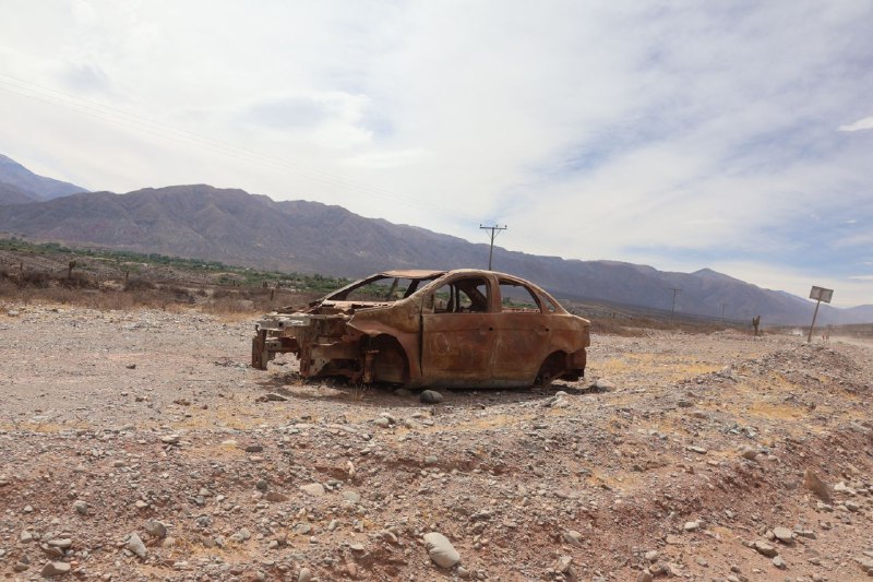
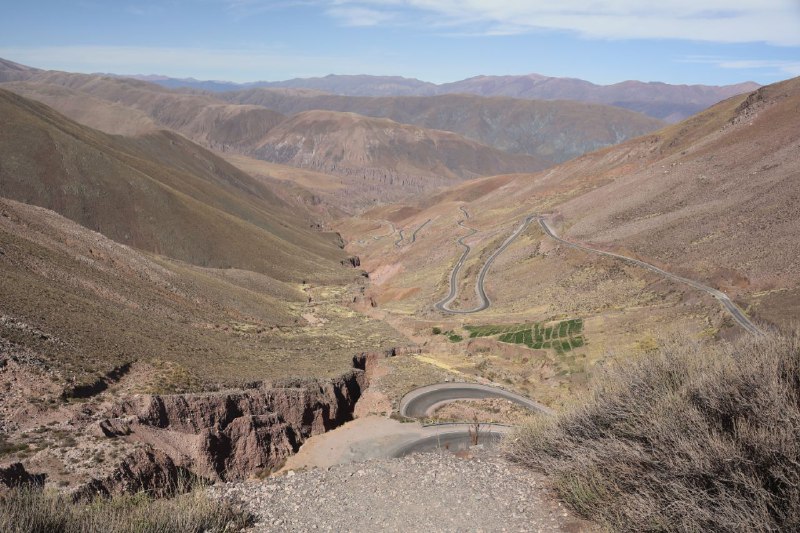
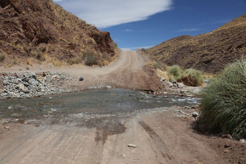
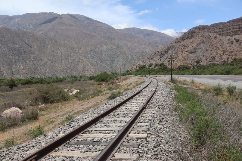
Most of the route is gravel of pretty rough quality. Sometimes I could manage 80-90 km/h, but other times I had to ford rivers, like in the last photo. And that's not even the widest crossing. Still, even a basic rental Fiat Cronos could handle it.
Here's what this Argentine Route 40 looks like. There's a lot more there, but this isn't the only post.
PS. I'll try to mirror the video on
YouTube, where the quality loss isn't as bad. It's all the same content, no unique material planned. Just better picture quality.
So I just realized I have a Telegram channel, and I haven't posted anything here in forever. I'm going to skip a couple of quick trips I took through Bosnia and Serbia for now—I'll tell you about those later. I've got some more interesting stuff to share.
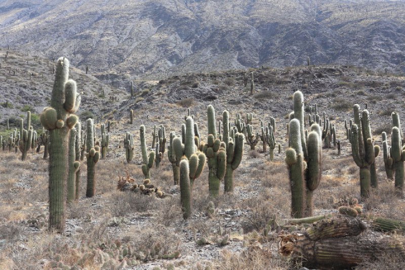
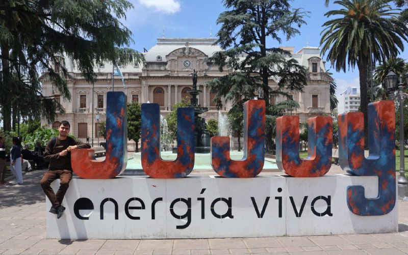
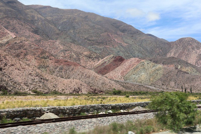
I ended up in this charming province called
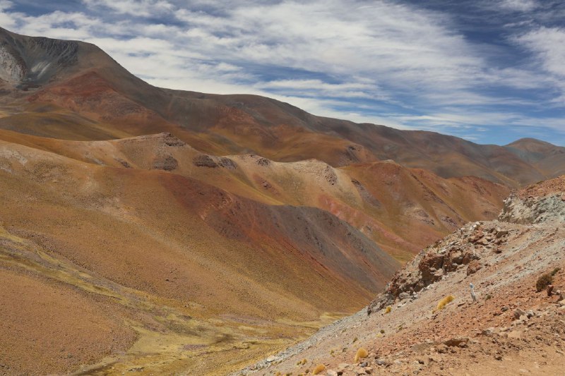
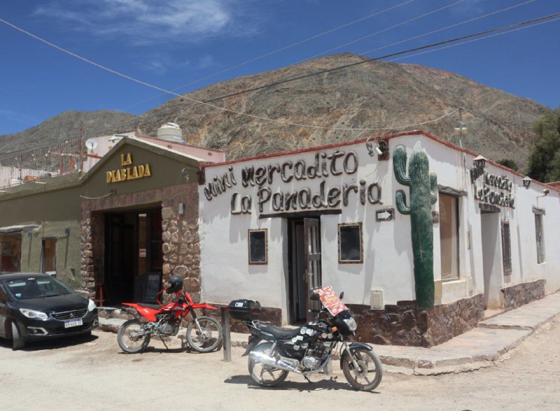
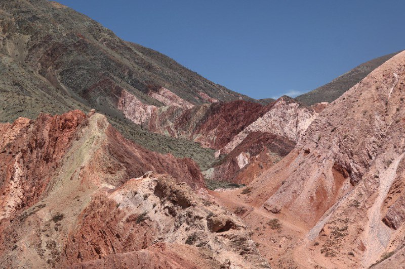
Jujuy way up in the north of Argentina. In the Southern Hemisphere, everything's backwards—the north is warm and the south is freezing. I even asked some locals about it, and they told me that when they think of the south, they don't picture beaches and warmth, but frost and glaciers. It's definitely noticeably warmer here than in the rest of the country. And the views are absolutely breathtaking literally at every turn. It feels like someone once held a nature exhibition here and just forgot to take the exhibits away.
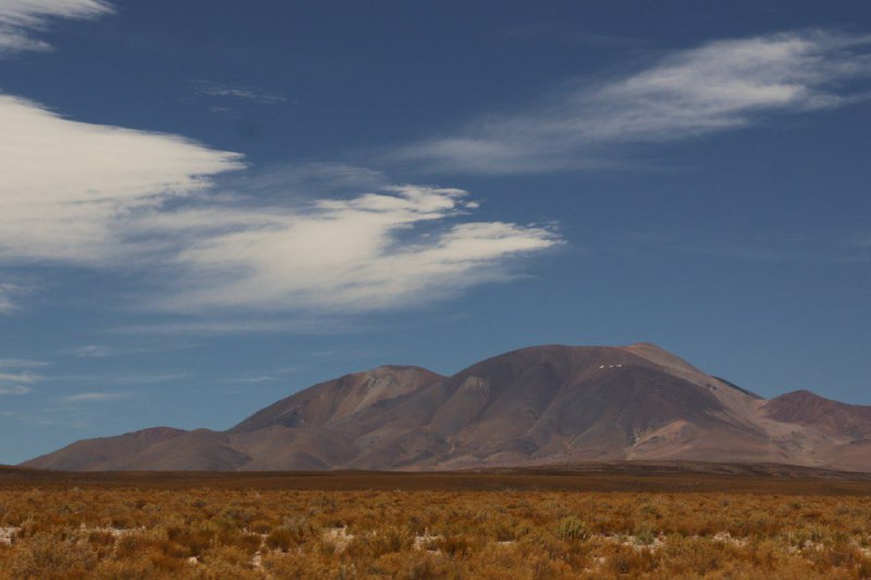
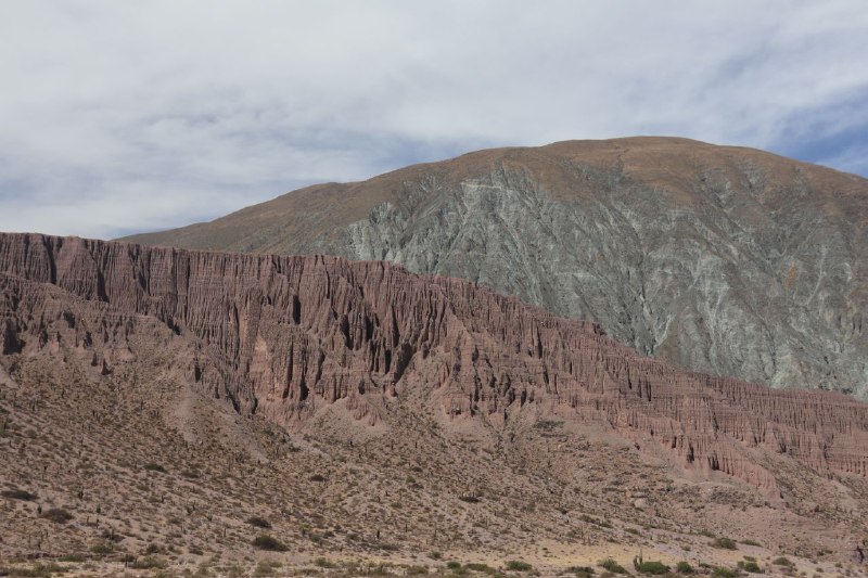
Everything is concentrated along Argentina's most famous and longest route—Route 40. I drove about 300 kilometers of the over 5,000 total, but the landscape kept changing so dramatically I barely recognized it. You could stop and take pictures every hundred meters or so.
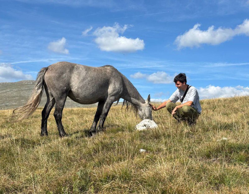
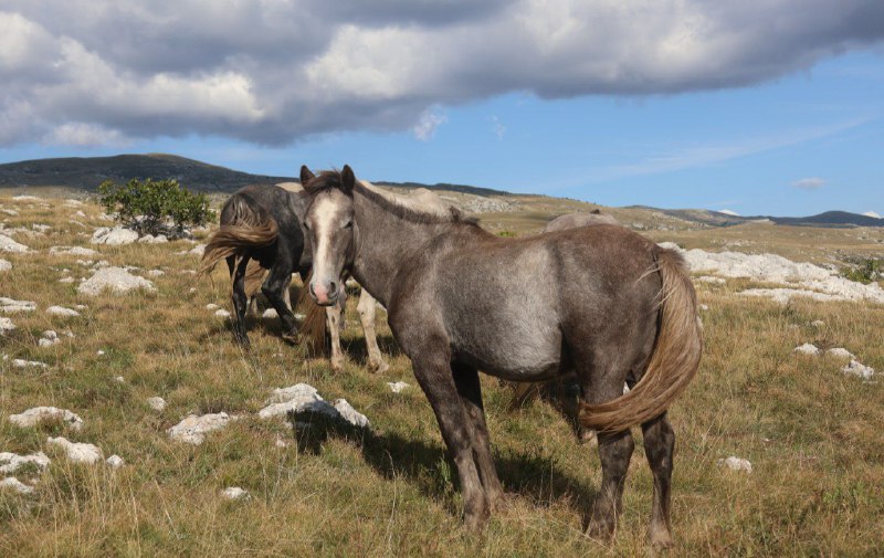
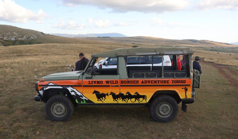
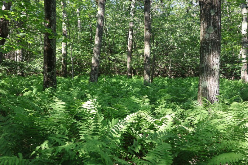
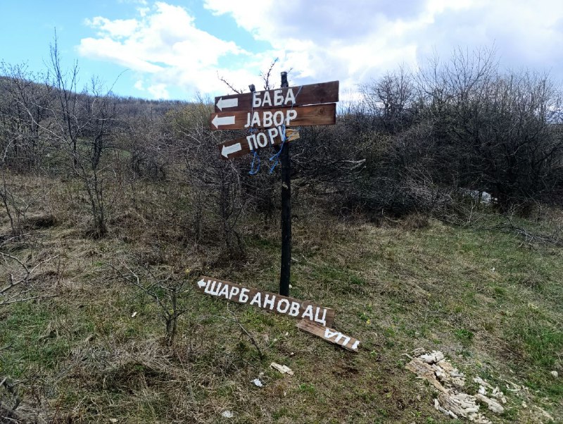
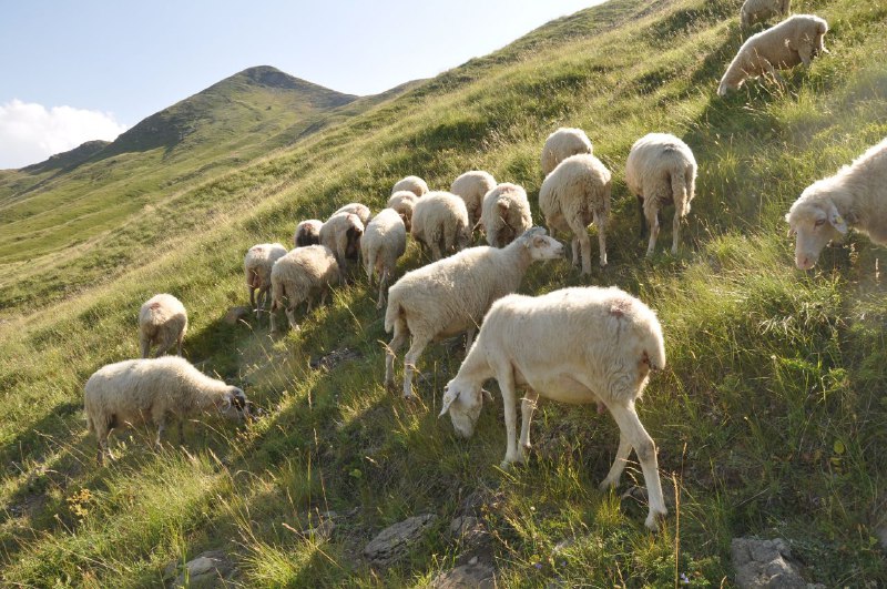
Wild horses live near Livno in Bosnia! I found out about them when I
passed through here last year, but only made it back now.
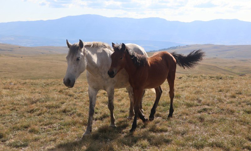
Until the mid-20th century, these horses were domesticated, but then industrialization hit and people no longer needed livestock in such large numbers. The locals of Livno didn't come up with anything better than just letting them all go free. Since then, the wild horse population has only grown, and today there are over 800 of them roaming the surrounding steppes. Fun fact: while reading the
Bosnian Wikipedia, I learned that livestock in the local language is measured in "grlice" (throats). They say 800 grlice instead of 800 heads.
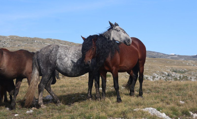
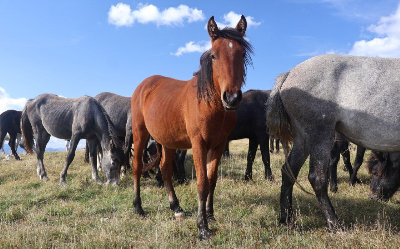
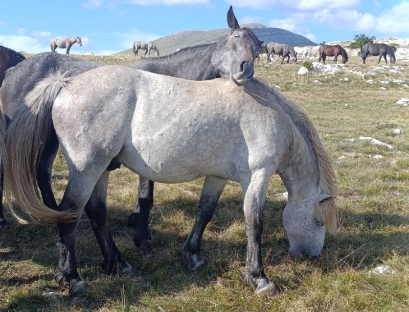
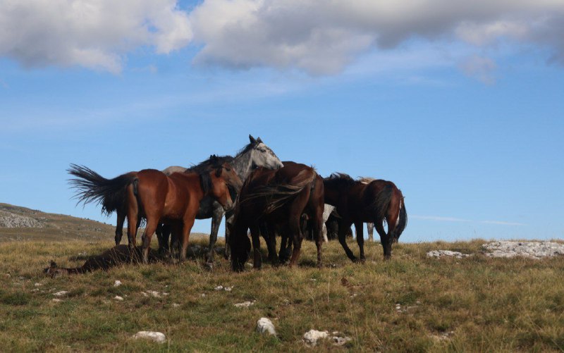
The horses are awesome. You can walk up and interact with them. They're not afraid of people, but they won't let themselves be pushed around either. The animals stand in small groups—family units. There are even family disputes sometimes. During those moments, it's best for people to keep their distance to avoid getting kicked.
The town has developed a whole "safari" industry. The variety isn't what you'd get in
Tanzania, but what can you do? Even locals come to see them. My group included guys from Travnik and a Croatian girl with beautiful
tattoo flowers. Actually,
spots where horses hang out most often are marked on Google Maps. But there's no guarantee they'll be there. If you go with a guide, they know where and how to search further. Plus, the roads to those spots are terrible. You feel bad for your car.
During especially harsh winters, people try to help the animals. There are entire
charitable organizations! And
here there are lots of videos from there.
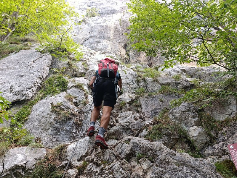
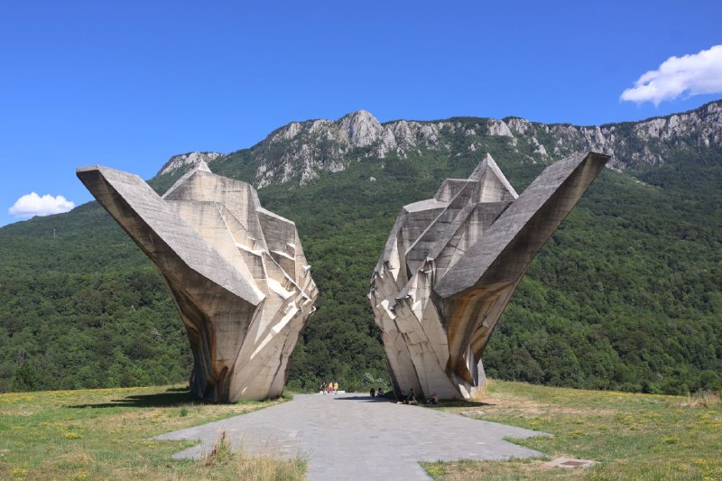
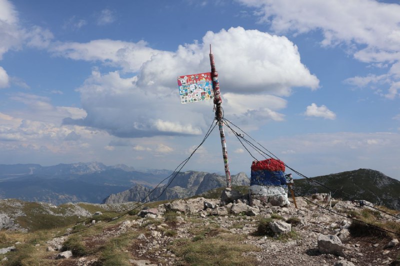
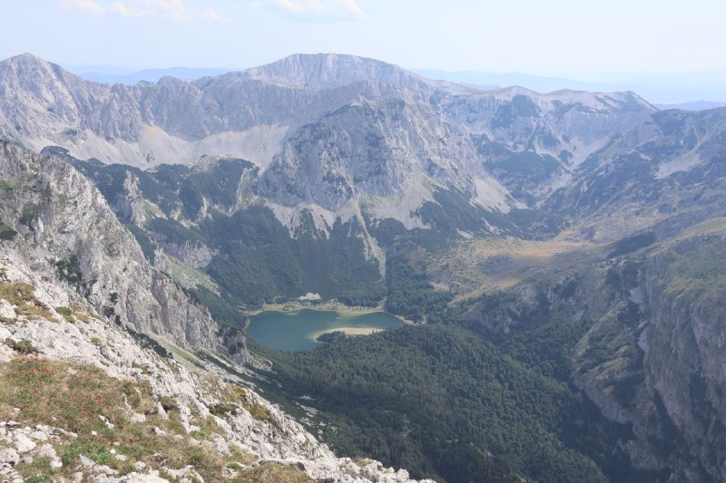
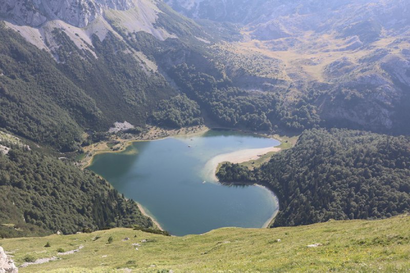
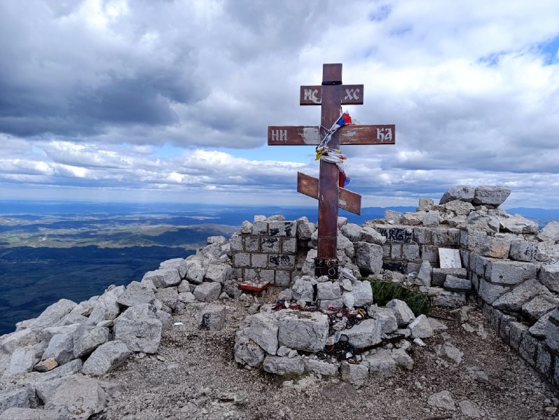
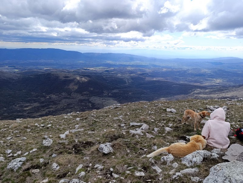
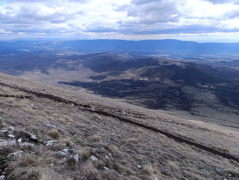
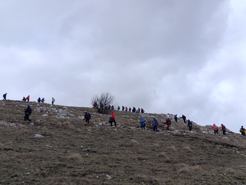
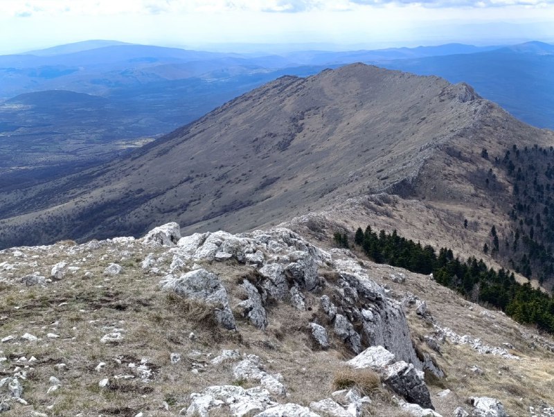
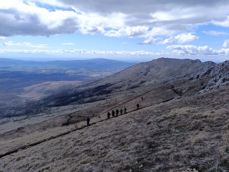
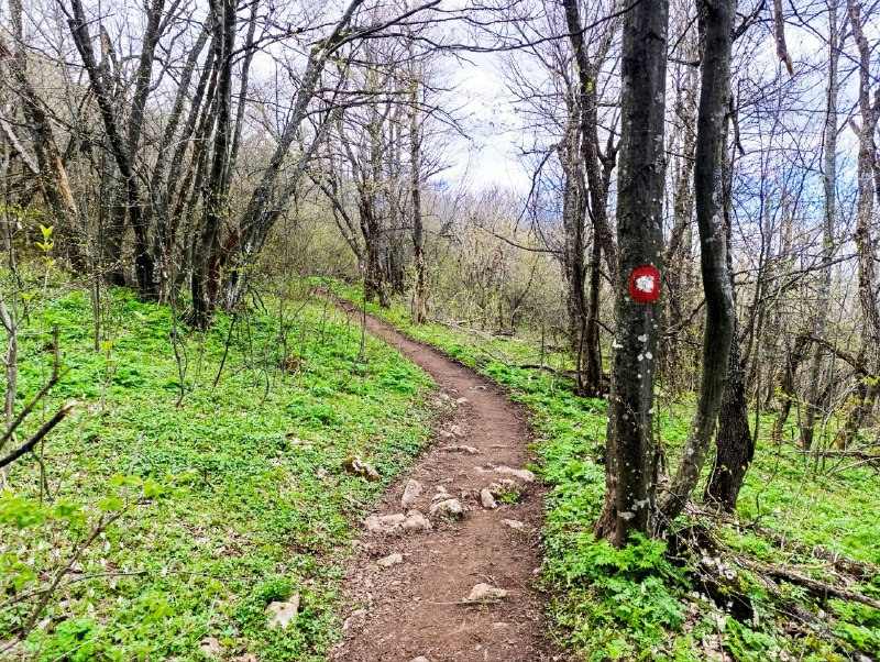
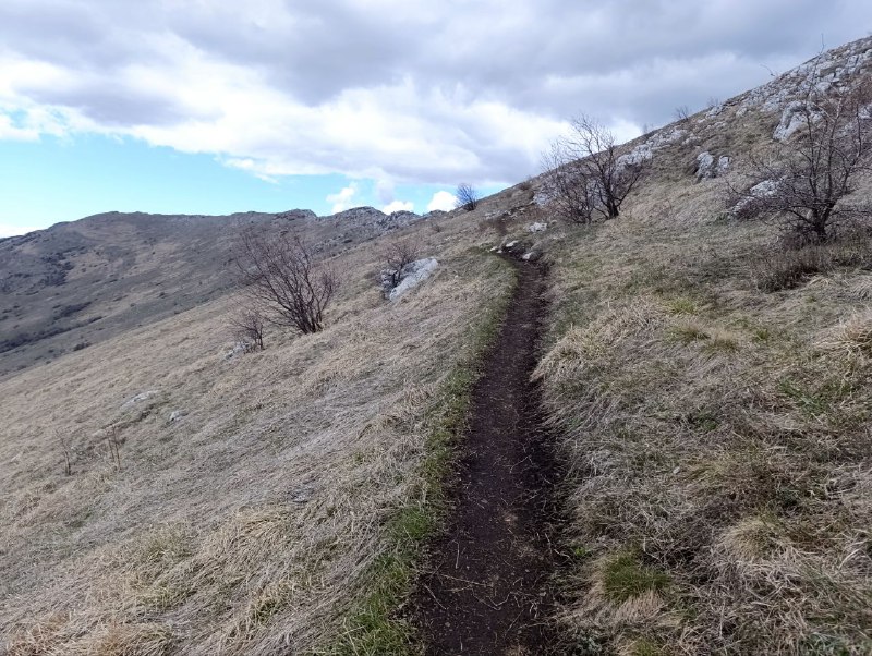
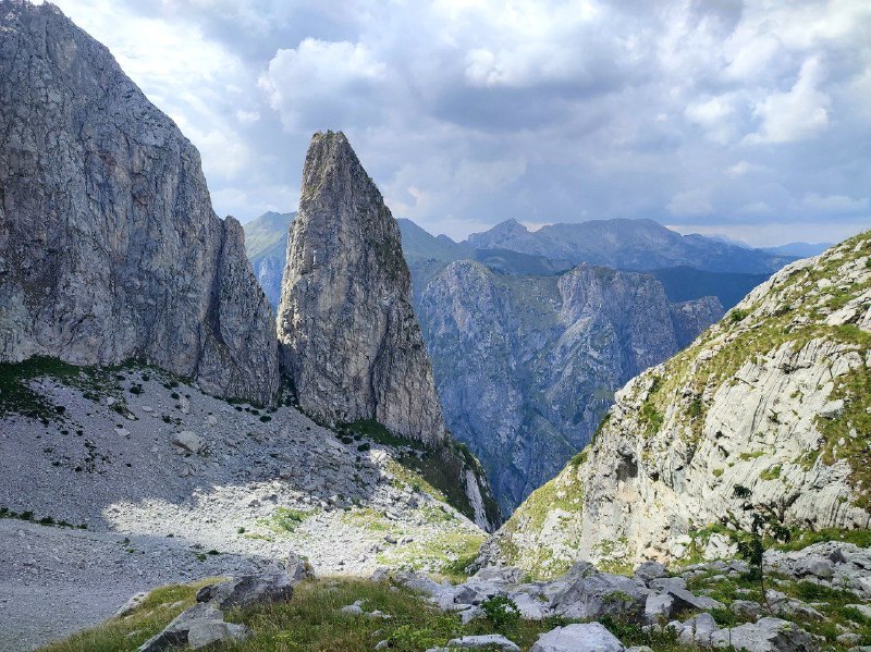
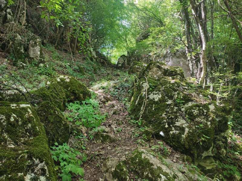
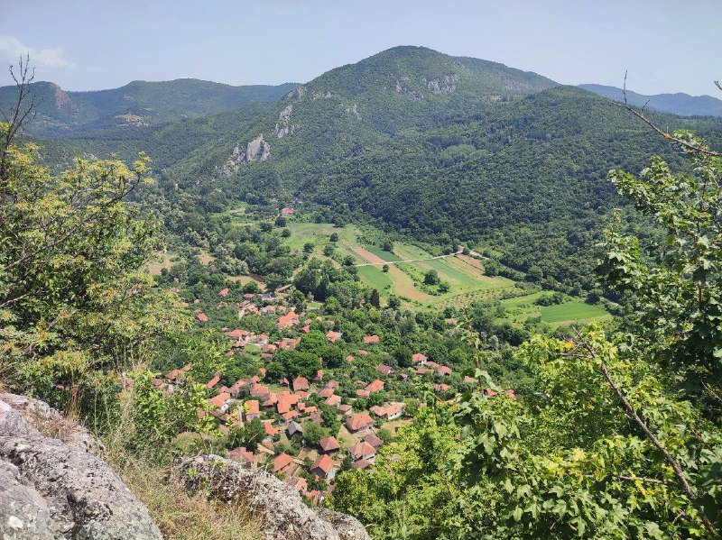
Sutjeska National Park has an amazing hike to Lake Trnovačko that takes you over Maglić, Bosnia's highest mountain. It's honestly one of the most breathtaking hikes I've done in the Balkans. The only thing I'd compare it to is
Prokletije. But it's definitely the toughest of the two. Some sections basically required light mountaineering. You don't actually need any gear—there are ropes set up at the difficult spots, but honestly check the anchors first because some of them looked pretty sketchy. If you're thinking about doing it, make sure you're up for the challenge. Here's
what it looked like.
So here's the thing—the hike starts in Bosnia, but the lake is actually in Montenegro. You're basically crossing the border, but there are no border guards or official crossings or anything. There's a little hut by the lake where you check in with your passport and pay 1 euro. When I got to the park entrance, I actually double-checked with the staff about how legit this whole thing was. They said it's totally fine—that's just how it works here.
There's also a direct trail straight to the lake without climbing the mountain. It's way easier, but you don't get to see the really spectacular stuff. I'm not sure it's worth doing honestly.
You've probably heard about the Lycian Trail in Turkey over the past couple of years. In the States, there's the
Appalachian Trail, which is more than 5 times longer. I managed to hike a small section of it. You can't find time for the entire route, but even the demo version is really great.
The trail became famous in the 1950s thanks to a woman from Ohio.
Emma Gatewood had a difficult life: a large family, regular beatings from her husband, sometimes nearly to death. On top of everything, her husband was found guilty of killing another man but wasn't imprisoned because they had 9 minor children. What humane justice existed in 1924 in the USA. Emma often went into the forest to find peace and quiet. Only by 1941 did she manage to get a divorce. Quite an extraordinary thing for those times. But her love for hiking never went away.
In 1949, Emma came across an article in National Geographic about the Appalachian Trail. It was written as if anyone could easily and simply walk all 3,500 kilometers without any special training. So the woman set off, but after a few days she got lost, broke her glasses, and ran out of food. Park rangers accidentally found her and convinced her to go back home. But her children never found out about the failed hike.
A year later, at age 67, she told her now-adult children that she was going for a walk. It didn't occur to anyone to ask how long she'd be gone. The walk lasted 146 days! From the beginning of May through the end of September. For the entire trail, she took only a shower curtain in case of rain and a backpack with a change of clothes. Local media immediately picked up the story and ran with it. Riding this wave of popularity, the woman started organizing an annual 6-mile hike in one of Ohio's parks. By the last one in 1973, 2,500 people showed up.
Emma completed the entire route two more times. At age 71 (!) and at 76 (!!). I'd love to be able to casually hike three and a half thousand kilometers at 70+.
It's been a while since I've covered Serbian stories. And this one comes with a whole legend involving wars and gold.
In the late 19th century, Samuel Minch, a German Jew from Czech Moravia, moved to Serbia and opened a textile factory in Paracin. Business was booming, and with extra capital on hand, his eldest son Julius convinced his father to invest in nearby coal deposits. This is how the first mines near Rtanj came to be.
Julius and his wife Greta mainly oversaw the coal mining operations. The business grew until World War I broke out. Eastern Serbia fell under German occupation, and the Minchs had to flee. After the war, they managed to reclaim their property. However, soldiers had heavily damaged the mines before retreating. It took rebuilding almost from scratch.
In 1931, Julius committed suicide. No one ever figured out exactly why. Greta took over all the coal operations, and to honor her late husband, she began building a church on top of Rtanj. I'm not entirely sure why a Jewish family decided to build an Orthodox church as a memorial to a deceased relative, but that's how it happened.
Over a thousand workers participated in the construction. Materials were delivered by donkeys (it's practically a vertical kilometer up there!). The project was completed in 5 years, in 1937.
Then World War II happened. The Germans seized everything again. But this time, there was no getting it back. After defeating Nazi Germany, Tito's officials decided that the German surname of this Jewish family was a clear sign of collaboration, and they nationalized everything.
In 1969, treasure hunters blew up the church. There's a legend that a wizard's palace once stood in this area with lots of gold hidden at the summit. By the 1970s, a real gold rush began here. Of course, no gold was ever found.
Rtanj in general attracts a lot of legends. From certain angles, its shape resembles a pyramid.
This theory didn't reach Bosnian proportions, but some people genuinely believe in it. In 2012, some folks were planning to take shelter here from the end of the world. And Rtanj tea made from
mountain savory is considered almost medicinal.
I really wanted to make it to the
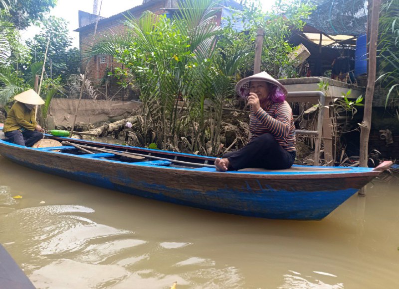
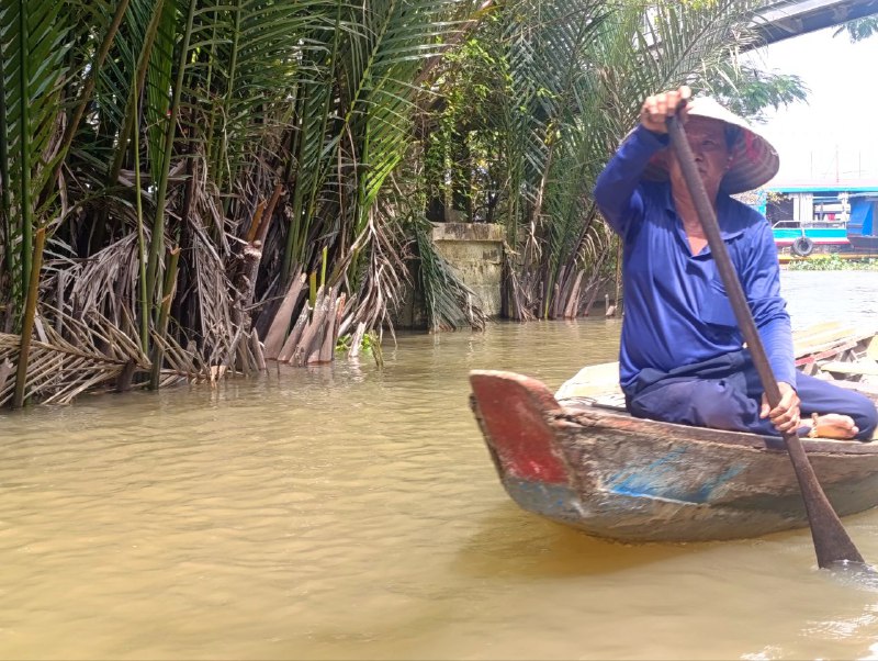
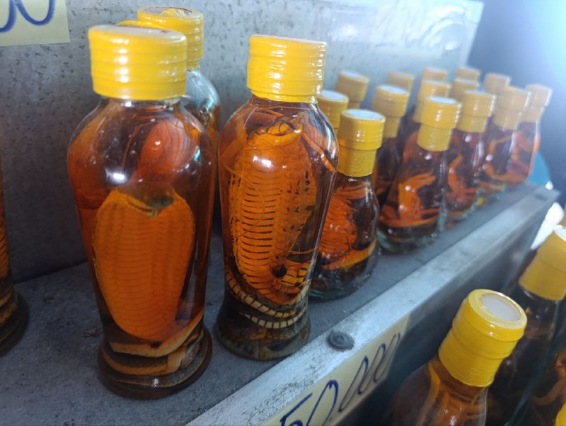
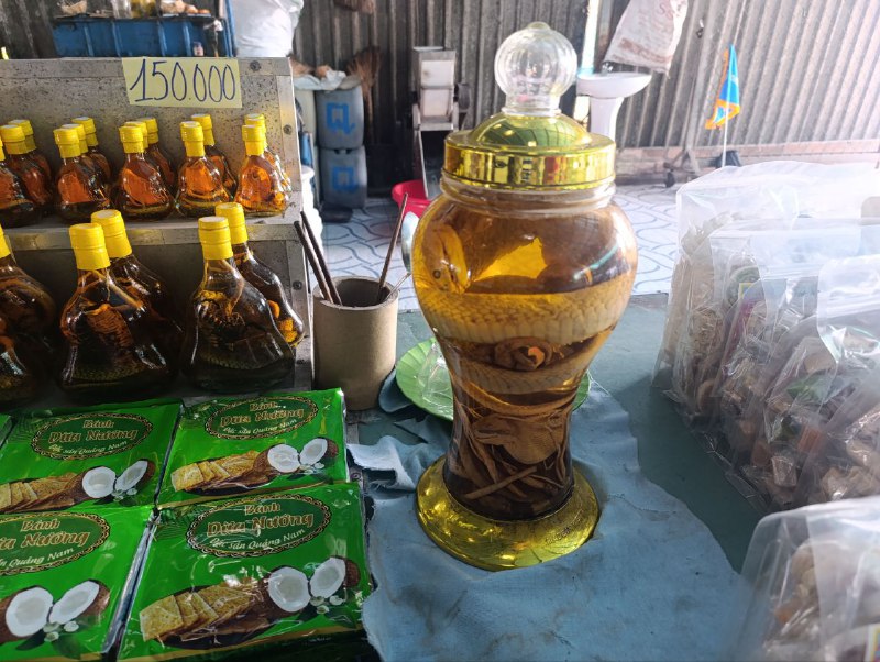
floating markets near Can Tho, but I only had time for the Mekong Delta. I'll save that for next time. In Mit Ho, everything is basically geared toward group tourists. Though honestly, the only really interesting thing is the boat tours. Travel guides talk a lot about snake farms, but based on Google reviews, they're not worth it.
I visited Podgorica a couple of years ago on my way to
Albania. Back then, the city seemed pretty unremarkable to me.
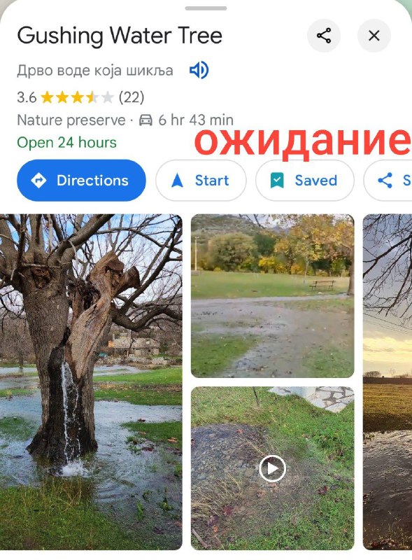
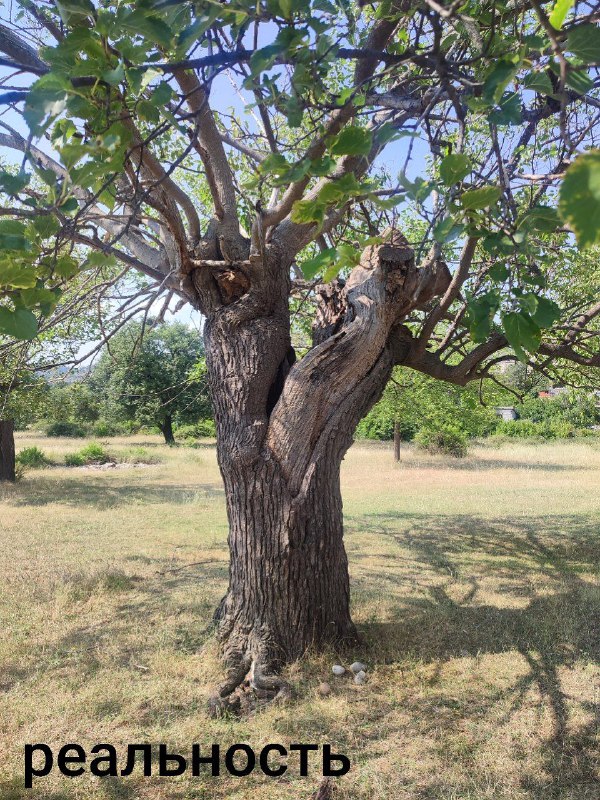
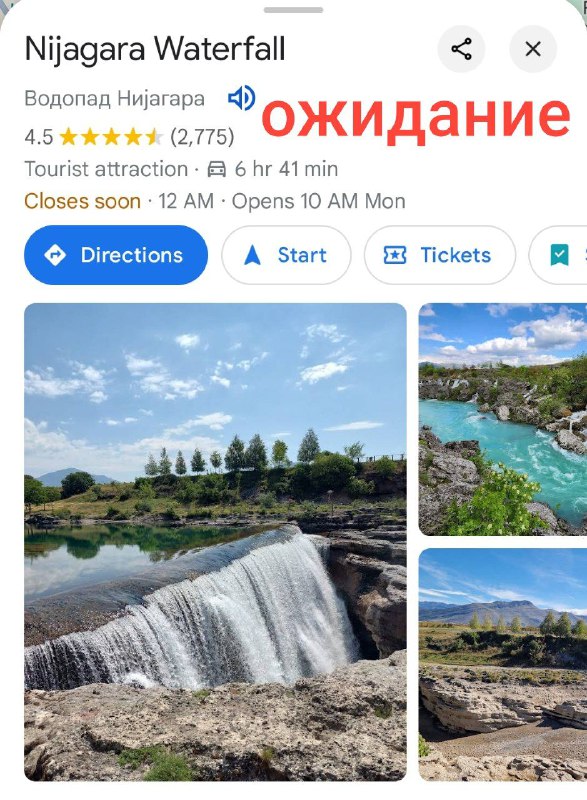
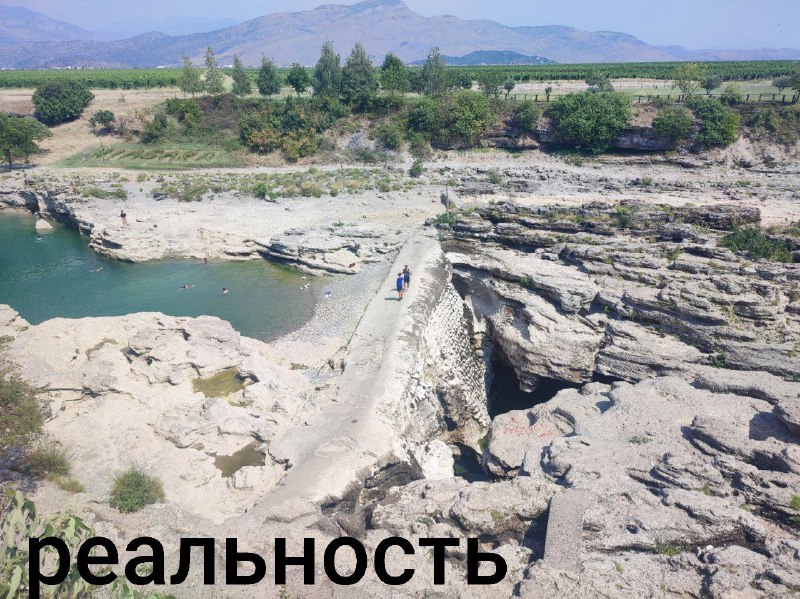
Not much has changed since, but I found a couple of interesting-looking spots on my map. A
tree with water flowing through it, and a massive
Niagara Falls waterfall (yes, that's actually what it's called).
I got a chance to visit them. Well, then. They probably would've made a better impression if I'd shown up at the right time. But in the dry summer, my expectations crashed hard against reality.
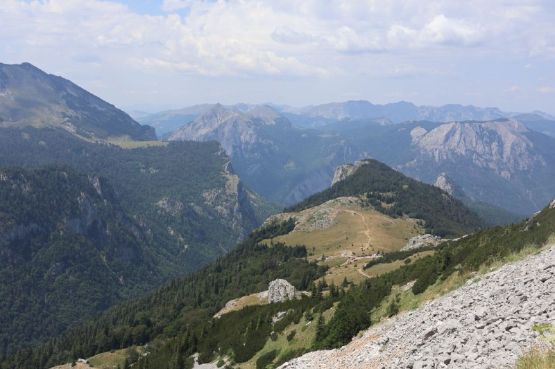
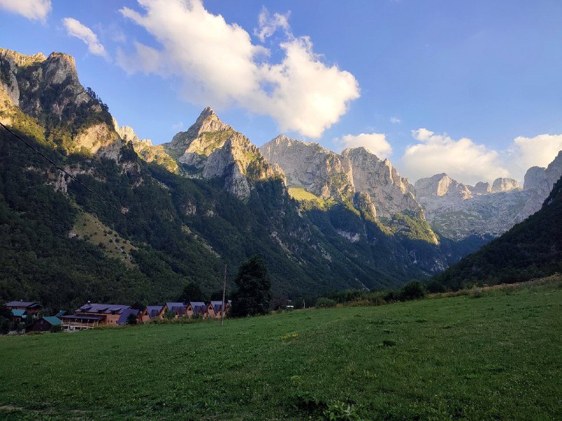
The drone views of Cursed Mountain are absolutely fantastic ❤️
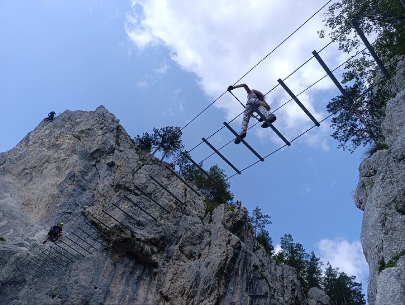
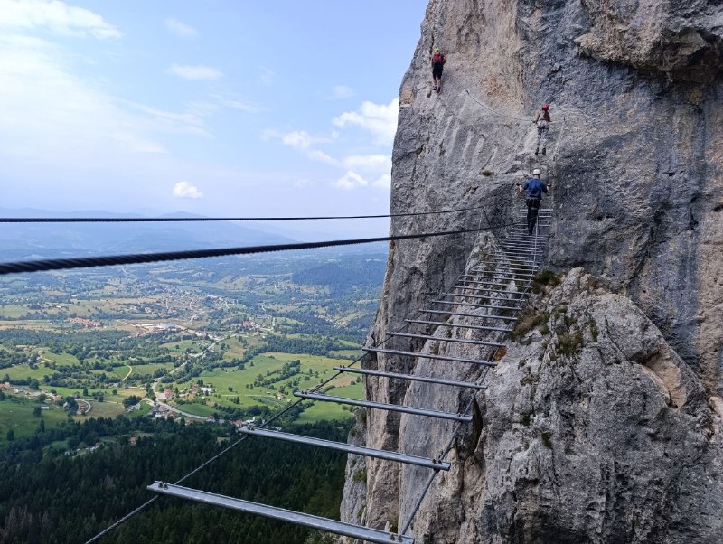
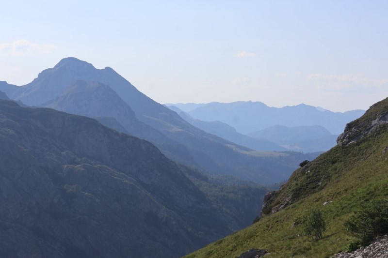
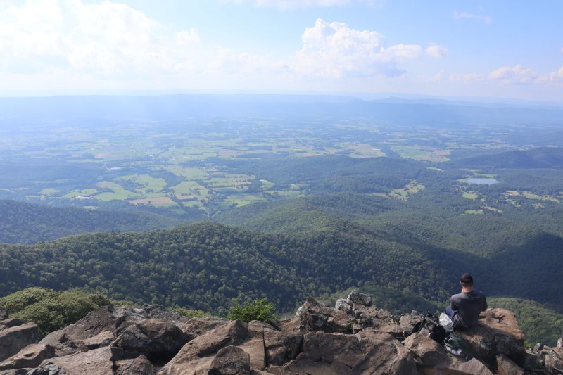
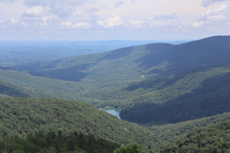
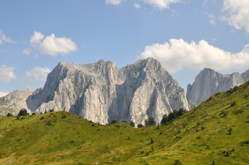
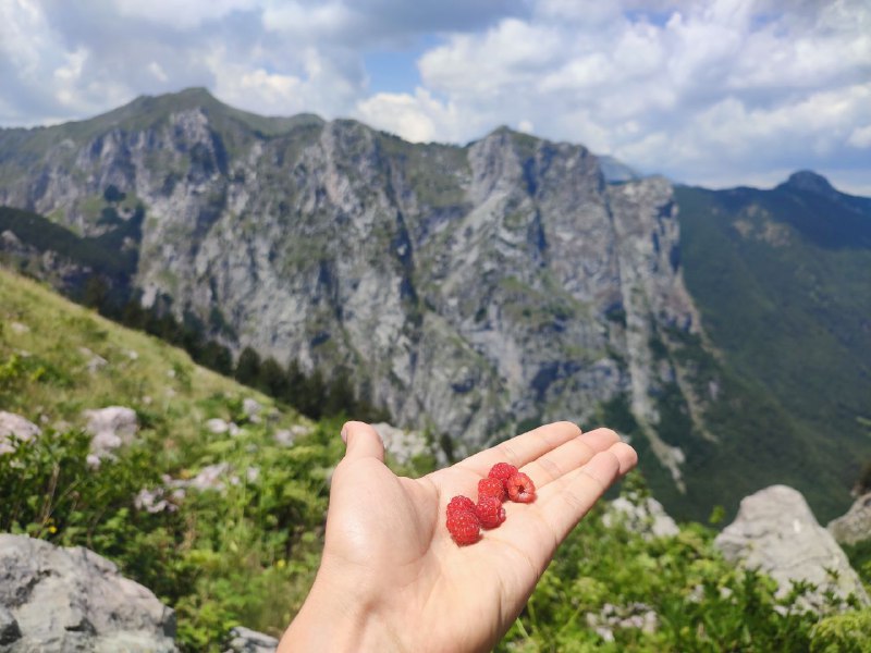
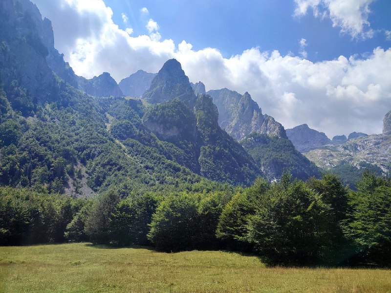
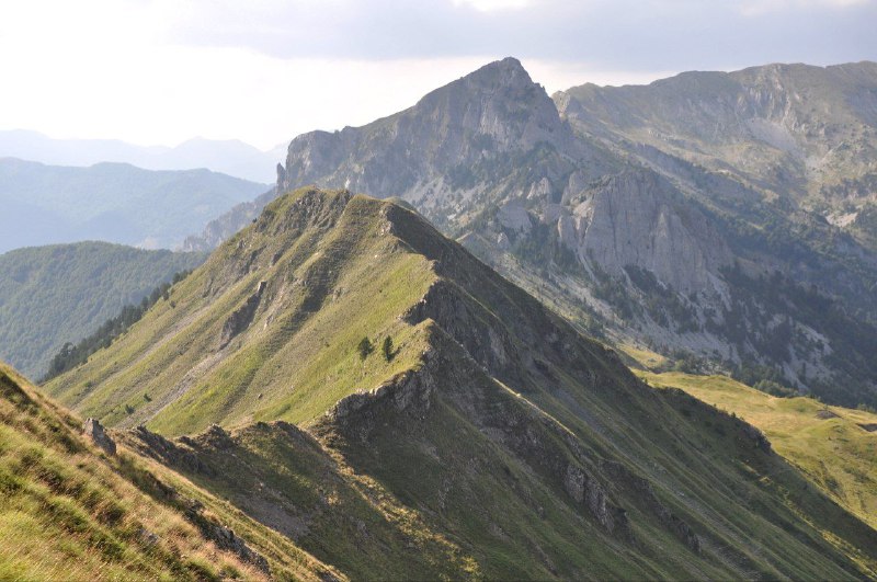
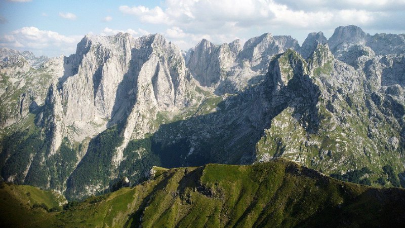
I've been wanting to make it to Montenegro's Prokletije for two years. And I finally made it!
These are some of the most stunning mountains I've ever seen. But you really need to choose your trails carefully. One of my routes was straight-up brutal—a vertical kilometer crammed into just 2 km of trail. Either way, you're guaranteed absolutely breathtaking views.
A couple years back I was on the
Albanian side of the park. The landscape there is more diverse, but honestly, the mountains on this side are way more impressive.
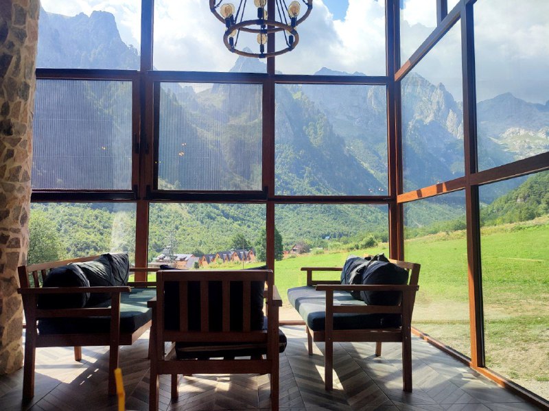
At the park entrance there's a
little restaurant with an absolutely stunning panoramic view (that's the last photo). And the food's pretty good too. Everything tastes amazing when you're coming back from a hike :)
And honestly, plan for more than just a couple days so you have time to recover between outings. There are three "classic" routes (
one,
two,
three). You can't realistically do all three in three consecutive days. And for the third one, you need to notify the Albanian police beforehand because it crosses the official border.
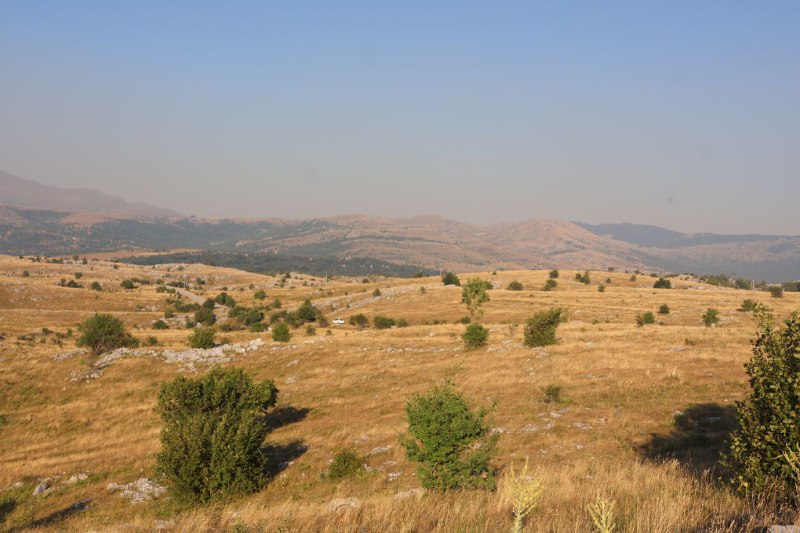
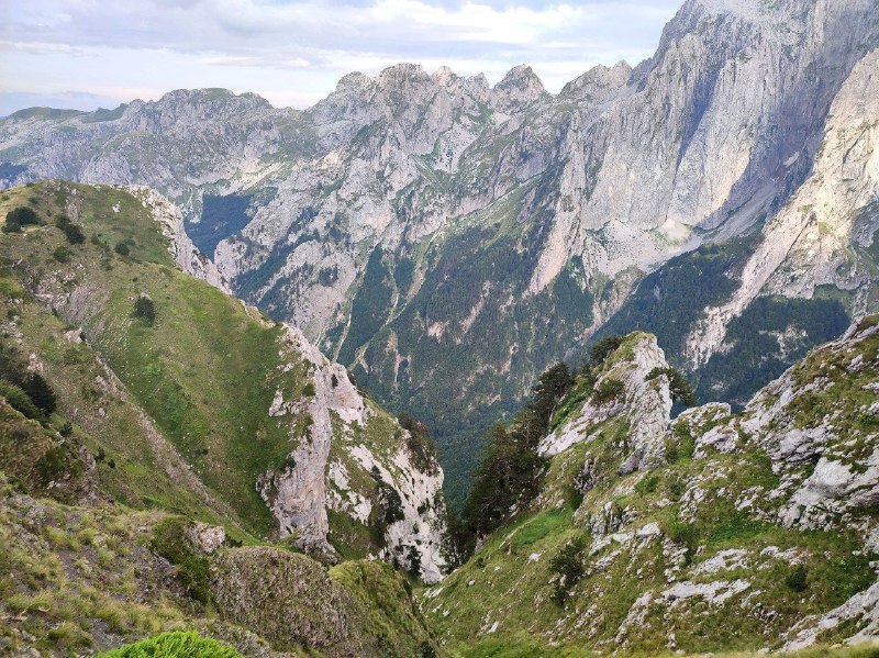
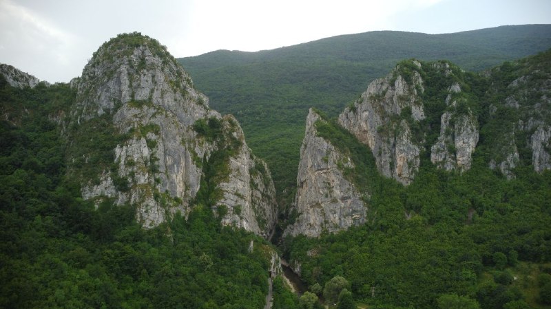
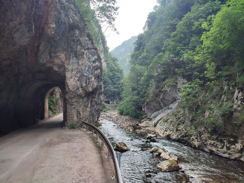
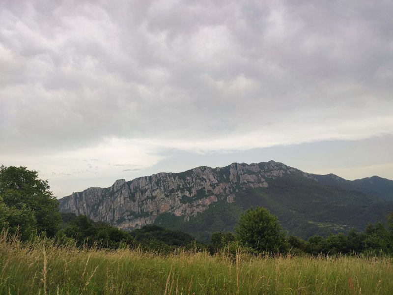
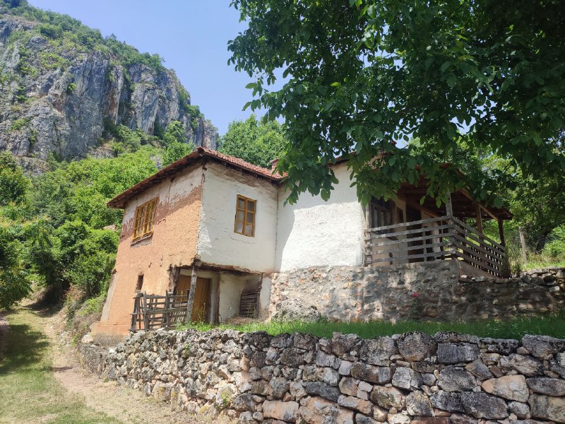
Yerma Canyon in southeastern Serbia looks absolutely stunning. A hundred years ago, it was completely impassable. Around the 1930s, a railway was built here for a nearby coal mine, and in the 1970s, after it closed, the tracks were replaced with asphalt. You can see clearly in the video that the road is literally carved into the rock. It's not a natural formation—people did this hard work.
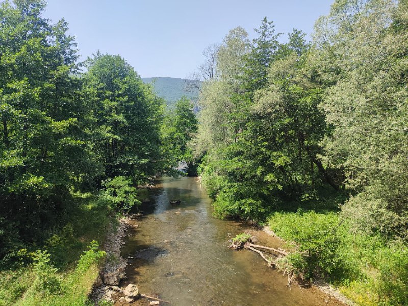
There are tons of hiking routes around here, but I didn't have the best luck with the weather this time. I only managed to reach
Ravni Kamika, and from the midway point to an entire
ridge of peaks, I had to turn back because a thunderstorm was rolling in. I'll definitely have to come back at least one more time.
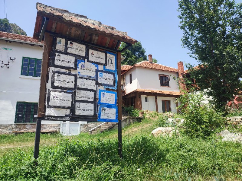
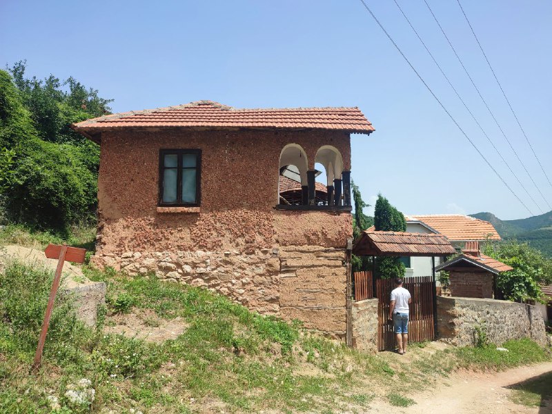
The surrounding villages are really charming. Though a bit weathered. But the houses are actually lived in—they're not abandoned.
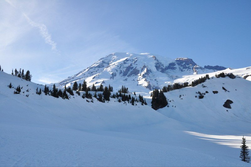
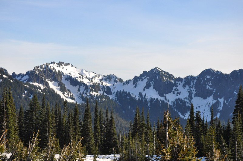
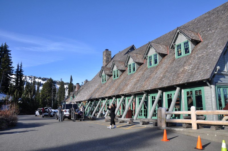
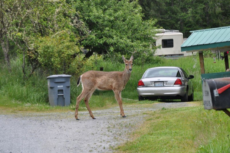
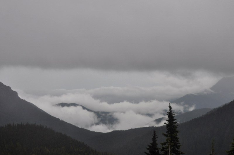
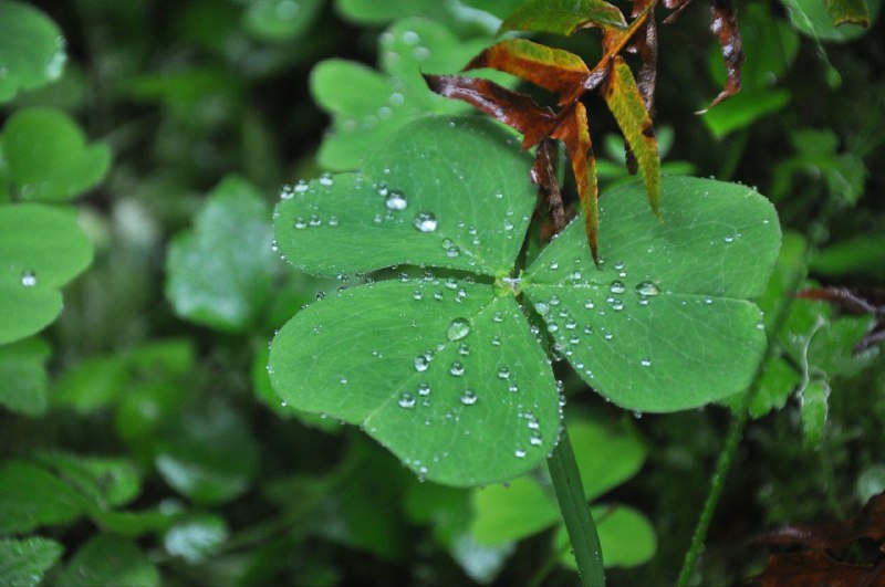
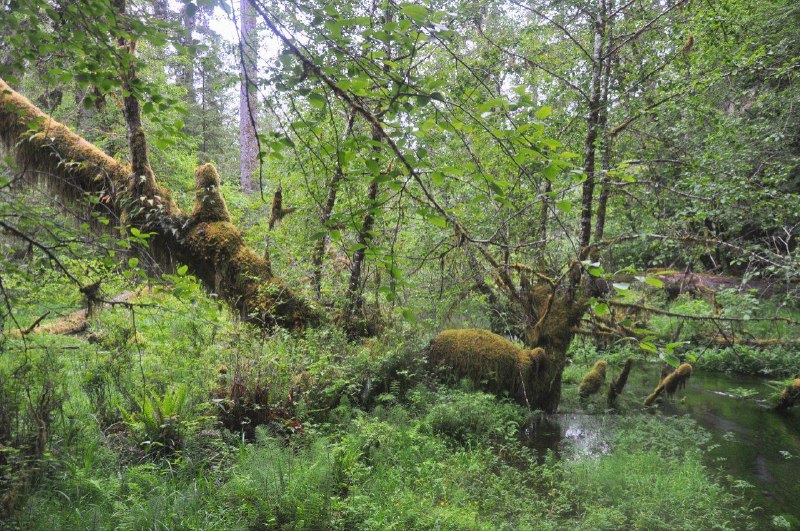
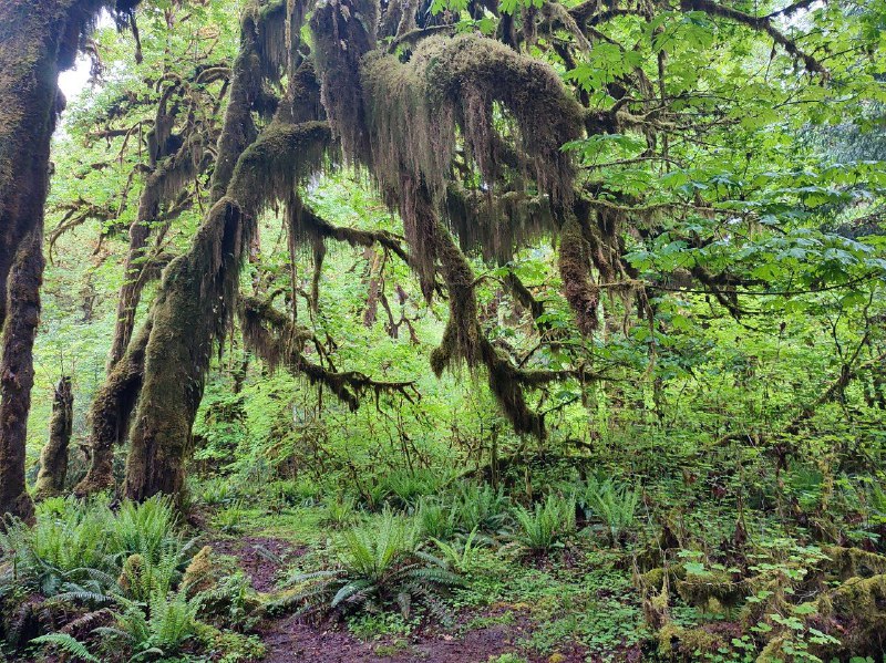
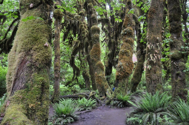
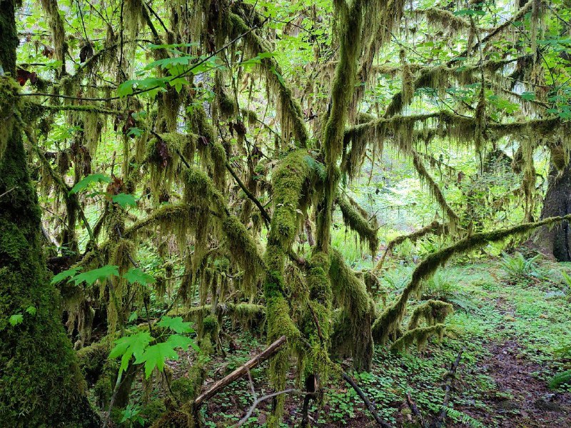
Seattle is definitely worth visiting for its nature – within a few hundred kilometers you've got the snow-capped Mount Rainier with glaciers, beaches right on the ocean, and even temperate rainforests.
Despite all that beauty, the climate is pretty gloomy. I was really lucky to catch a couple of sunny days. Though honestly, even the nearby towns have a melancholic vibe when the weather's nice. Apparently that helped produce a whole generation of musicians: Nirvana, Jimi Hendrix, Soundgarden, Pearl Jam, and other world-famous guys. In Aberdeen, where Kurt Cobain was born, they added an official "Come as you are" sign at the entrance next to the city nameplate.

 United Kingdom
 Serbia
 Bosnia and Herzegovina
 Turkey
 United Arab Emirates
 Brunei
 Indonesia
 Malaysia
 Argentina
 USA
USA Morocco
 Georgia
 Egypt
Egypt Hong Kong
 China
China Vietnam
 Tunisia
 Montenegro
 Philippines
 Singapore
 Oman
Oman Algeria
 North Macedonia
 Lebanon
 Israel
 Albania
 Russia
 Tanzania
 Netherlands
 Spain
Spain Latvia
 Germany
 Belgium
 France
 Kazakhstan