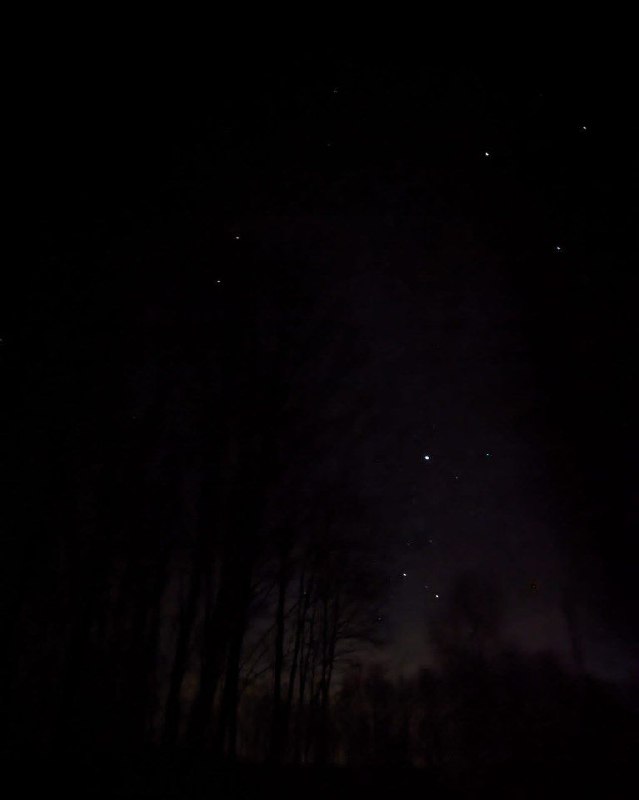
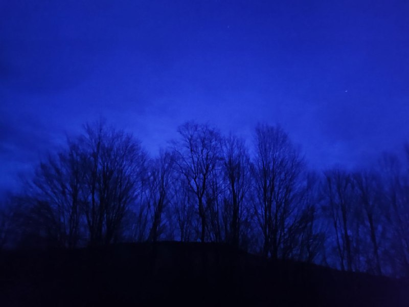
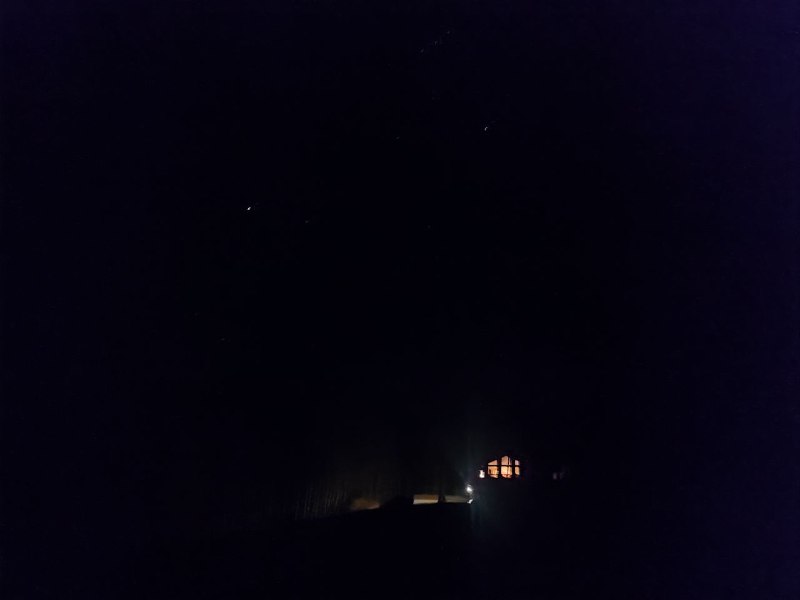
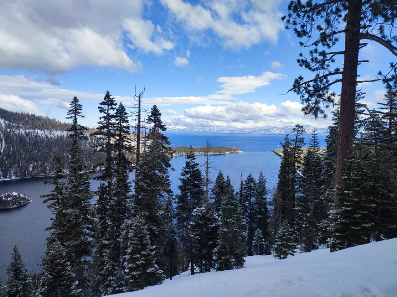
At night, when there's no moon, it gets so dark that you literally can't see where you're stepping without a flashlight. But the stars are absolutely stunning. I didn't bring a proper camera with me, so I just made do with my phone, sorry about that. Trust me, it's even more beautiful in person (:
Telegram mirror
Telegram is a messenger where I post short travel notes. This page is a self-hosted backup of that channel.
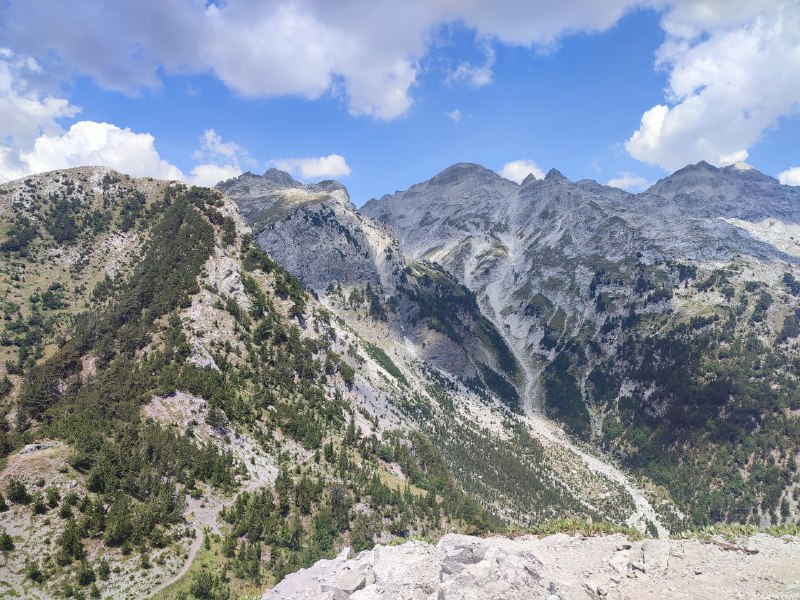
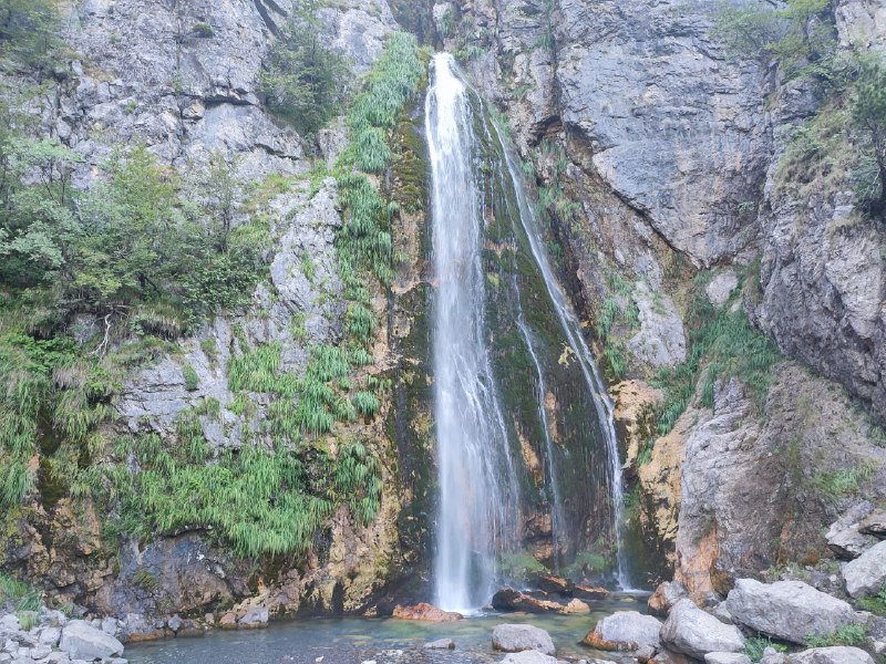
I really needed to go back to Lazarev Canyon. For some reason, I thought it would be all yellow, but it turned out to be multicolored, and honestly, that's even better.
The way I felt, I could have gone back a week later. Or even two weeks. If the leaves don't fall, the colors will be even more vibrant. Although I have completely different plans for next weekend. But yesterday's trip turned out great. Autumn is the best time to visit the canyon if you haven't yet.
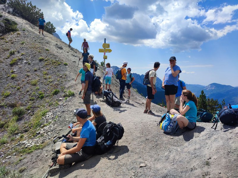
This time there were actually people on the trail! Over the summer, I'd run into maybe 3-4 people all day, but now there were even large groups. Guess it's peak season :)
During a break, my neighbors were discussing the funny names of the viewpoints: Amazing Lazarov kanjon viewpoint and Best viewpoint of Lazarov kanjon. I checked—the names don't lie! Those are genuinely the best spots.
To mix things up besides rock scrambling, I also explored Lazareva Cave below the mountain. It's cool, but more as a bonus activity. The plus side: it stays really cool inside. I remember it was late October, but I was hiking in just a t-shirt (and I wasn't the only one) because otherwise it would be too hot.
The way I felt, I could have gone back a week later. Or even two weeks. If the leaves don't fall, the colors will be even more vibrant. Although I have completely different plans for next weekend. But yesterday's trip turned out great. Autumn is the best time to visit the canyon if you haven't yet.
This time there were actually people on the trail! Over the summer, I'd run into maybe 3-4 people all day, but now there were even large groups. Guess it's peak season :)
During a break, my neighbors were discussing the funny names of the viewpoints: Amazing Lazarov kanjon viewpoint and Best viewpoint of Lazarov kanjon. I checked—the names don't lie! Those are genuinely the best spots.
To mix things up besides rock scrambling, I also explored Lazareva Cave below the mountain. It's cool, but more as a bonus activity. The plus side: it stays really cool inside. I remember it was late October, but I was hiking in just a t-shirt (and I wasn't the only one) because otherwise it would be too hot.
Not every hike goes smoothly. But when you do everything yourself, it's not as disappointing. This time though, I have someone to blame (:
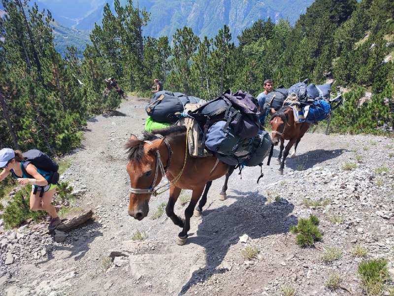
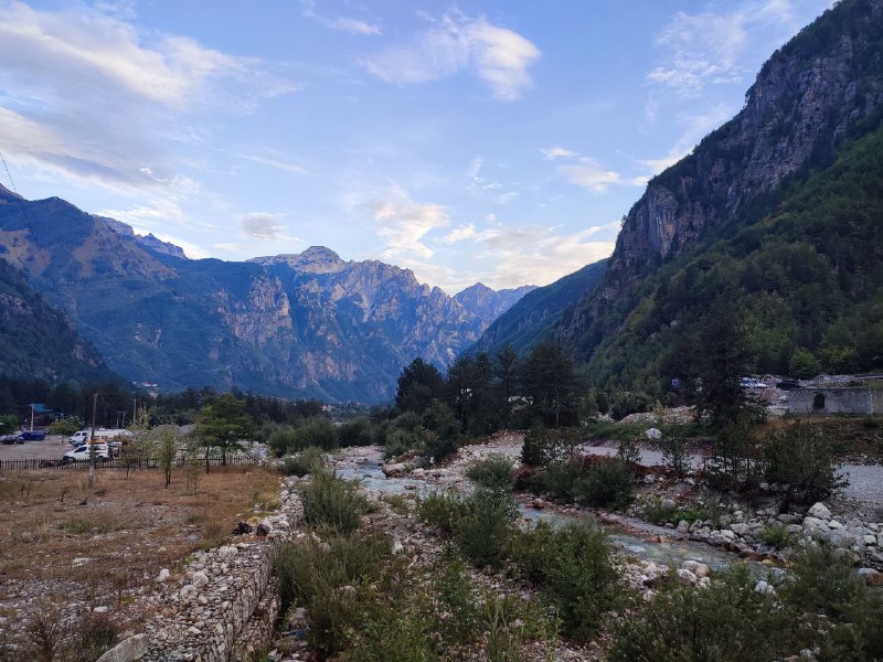
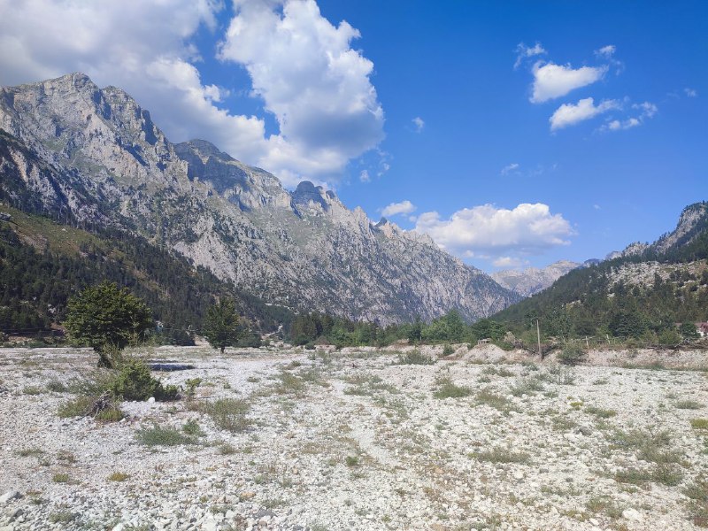
Despite my dislike of large group outings, I fell for the local hiking club's offer of a night ascent to Suva Mountain (1810m above sea level; starting from ~900m). "I'd never go climbing an unfamiliar mountain in the dark alone, but these folks know what they're doing," I thought, and signed up. I was also curious how organized tourism works here.
funfact: You can pay for the trip either at the hiking club office or with an "electronic" payment at the nearest post office. Why it's called electronic isn't entirely clear (:
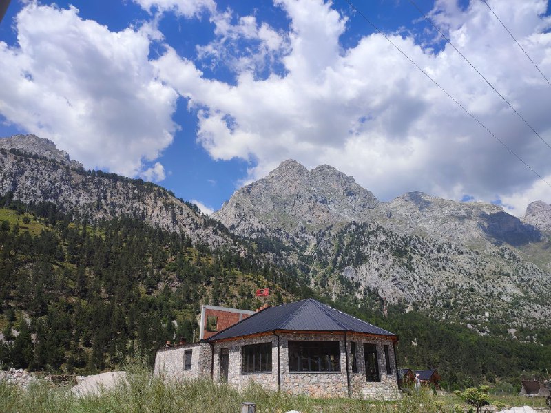
The plan was simple: arrive around midnight at the trailhead, climb to the top, catch the sunrise, and head back. The description really oversold the difficulty of the climb and the winter cold at the summit. In reality, everything was the opposite: the trail was comfortable, the top was fresh but not cold.
The place is fantastic, definitely worth going. But the organization fell short: there were too many people, and part of the group with the main guide rushed ahead and then agonizingly waited for the second half to catch up. Then the rested, faster folks waited for the tired, slow ones to recover. In the end, I spent half the hike in painful waiting (:
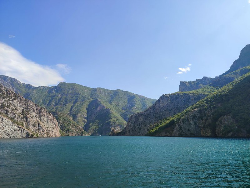
But while you can come to terms with waiting, you can't with missing out on beauty. Well, actually there were beautiful views, but we barely got to see them. During the night climb, the starry sky was magnificent—I hadn't seen anything like it in ages. As dawn approached, we got engulfed in clouds and watched the sunrise from inside them. Early morning in such places, that's usually the story—you often need to wait a bit to see something interesting. But the guide decided to head back through the curtain of water. About an hour later, I looked back and the summit was almost completely cleared. Well, so be it. Maybe next time.
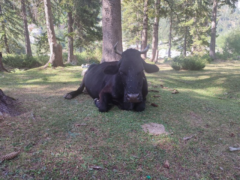
At least we walked through the fog. It was amusing to suddenly encounter a herd of cows in it. All the beauty ended up being shown well below the summit, but even there it was lovely.
Despite my dislike of large group outings, I fell for the local hiking club's offer of a night ascent to Suva Mountain (1810m above sea level; starting from ~900m). "I'd never go climbing an unfamiliar mountain in the dark alone, but these folks know what they're doing," I thought, and signed up. I was also curious how organized tourism works here.
funfact: You can pay for the trip either at the hiking club office or with an "electronic" payment at the nearest post office. Why it's called electronic isn't entirely clear (:
The plan was simple: arrive around midnight at the trailhead, climb to the top, catch the sunrise, and head back. The description really oversold the difficulty of the climb and the winter cold at the summit. In reality, everything was the opposite: the trail was comfortable, the top was fresh but not cold.
The place is fantastic, definitely worth going. But the organization fell short: there were too many people, and part of the group with the main guide rushed ahead and then agonizingly waited for the second half to catch up. Then the rested, faster folks waited for the tired, slow ones to recover. In the end, I spent half the hike in painful waiting (:
But while you can come to terms with waiting, you can't with missing out on beauty. Well, actually there were beautiful views, but we barely got to see them. During the night climb, the starry sky was magnificent—I hadn't seen anything like it in ages. As dawn approached, we got engulfed in clouds and watched the sunrise from inside them. Early morning in such places, that's usually the story—you often need to wait a bit to see something interesting. But the guide decided to head back through the curtain of water. About an hour later, I looked back and the summit was almost completely cleared. Well, so be it. Maybe next time.
At least we walked through the fog. It was amusing to suddenly encounter a herd of cows in it. All the beauty ended up being shown well below the summit, but even there it was lovely.
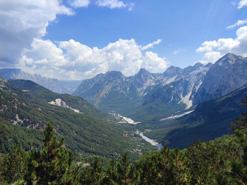
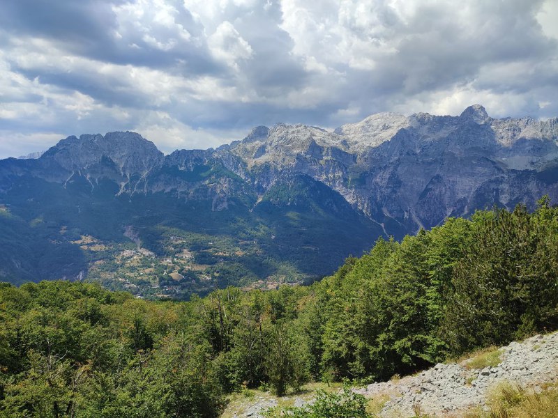
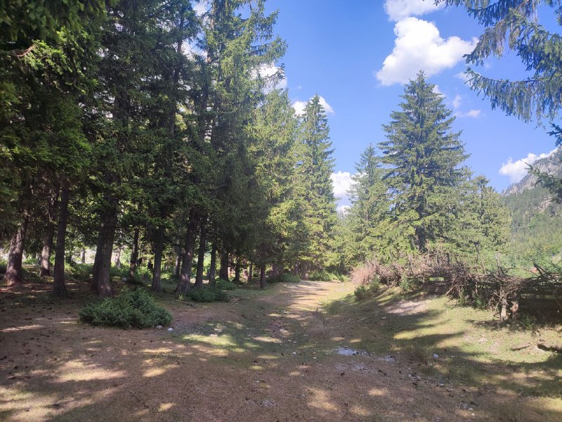
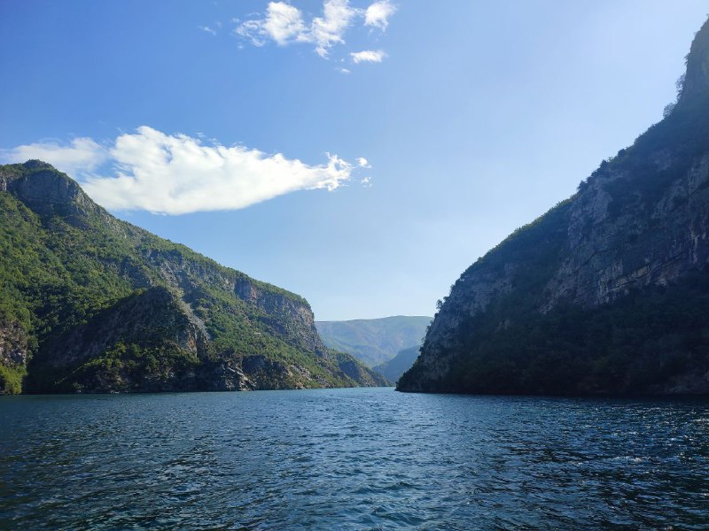
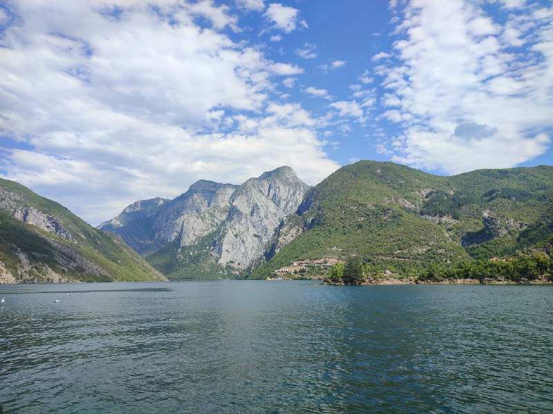
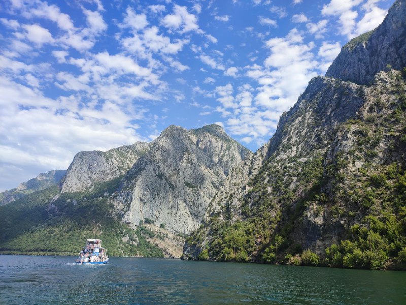
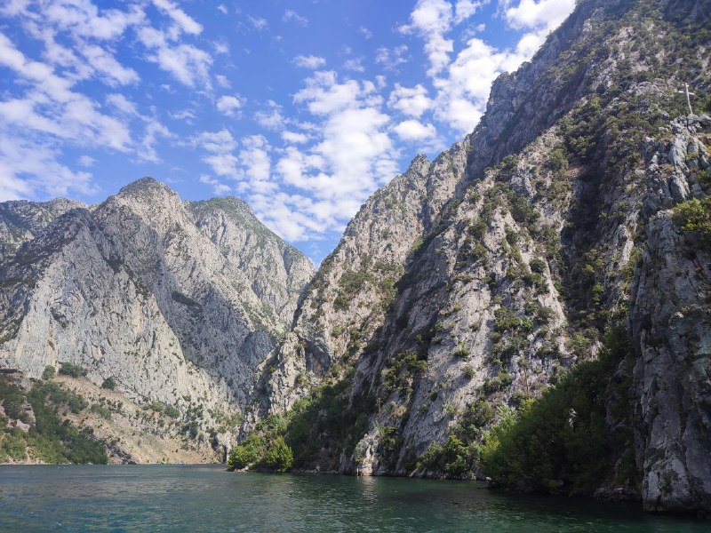
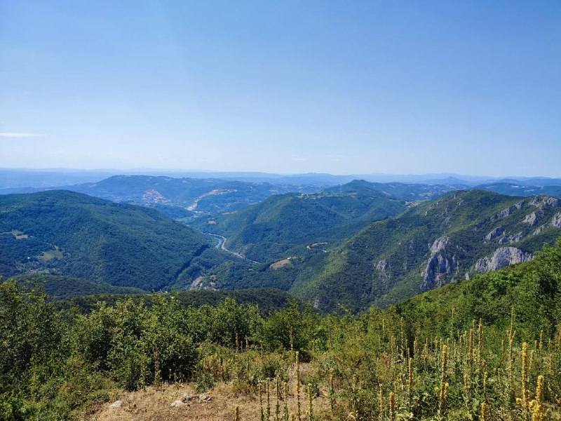
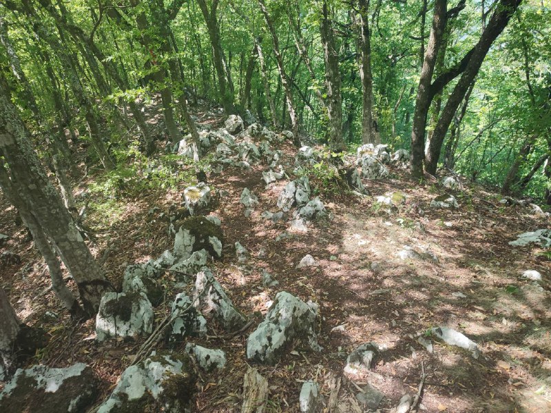
Когда я наткнулся в интернетах на картинки Лазарева каньона, сразу стало ясно, что мне срочно туда надо. И вот я доехал.
Виды невероятные. Всего 230 км от Белграда и можно хайкать. Что ещё нужно? (:
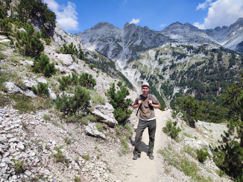
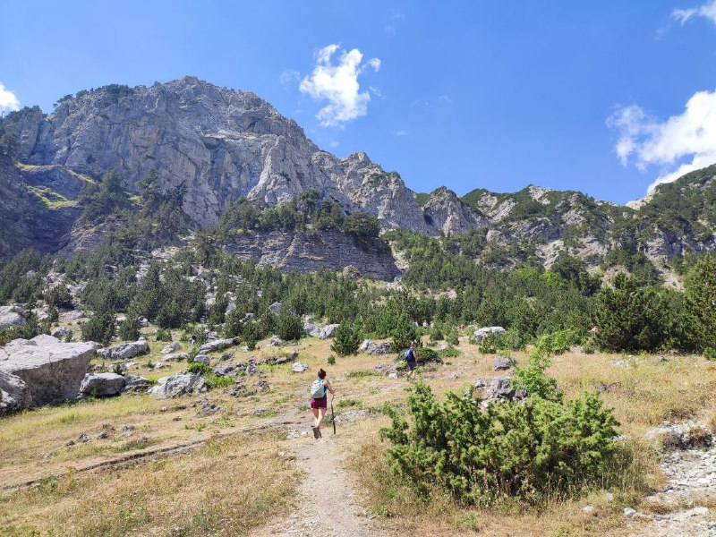
Не обошлось без приключений. Я заранее нашёл разные маршруты, выбрал, как я наивно полагал, оптимальный круговой. Первые километров 10 были идеальными. А дальше появились тропинки Шредингера: идёшь себе, а тропа внезапно заканчивается и куда идти — непонятно. Хотя на карте путь четко обозначен.
В такой ситуации сразу думаешь "А может обратно той же дорогой, что и пришел?". Но смотришь, что уже пройдено больше половины, только что был хороший спуск, и решаешься проверить вдруг это просто локальный участок зарос. Как-то пробираешься вперед, и вроде вполне терпимо выходит. И чем дальше уходишь, тем всё менее привлекательным становится вариант с разворотом.
Уверенности в решении идти вперед добавило то, что тропа через какое-то время действительно появилась снова. Но история с пропажей дорожки повторилась не раз. Что совершенно удивительно: иногда путь был отличным, с отметками и указателями. А потом заканчивался так же неожиданно, как и начинался. Как люди попадают на старт такого отрезка для меня осталось загадкой. Признаков телепорта замечено не было.
Где-то пришлось буквально прыгать по поваленным деревьям и прочим буеракам. В итоге вместо ожидаемых 20 километров вышло чуть больше 30 (пришлось идти в обход), и еле удалось успеть выбраться в цивилизацию до темноты. Справились почти за 10 часов с парой недолгих привалов.
Вживую красота неописуемая. Гораздо лучше, чем на фотографиях. Я очень рад, что получилось сюда добраться. Все трудности и мучения с лихвой окупились. Но если соберусь второй раз, то кругом уже не пойду. Скорее буду придумывать что-то с тремя самыми интересными точками (один, два, три).
Тут бегает всякая животина. Попались (предположительно) безногая ящерица (не путать со змеей) и пугливый олененок, который преследовал нас четверть дороги. Пару раз выбегал на видное место покрасоваться, но фотографировать с близкого расстояния не давался. Под вечер стало слышно сов.
Непонятно почему настолько впечатляющее место активно не развивают. Проложить здесь человеческие тропы, пустить рекламу, и хороший поток посетителей гарантирован. Всяких немцев хлебом не корми, дай по природе полазать. За весь день не встретил ни одного туриста. Даже обидно.
PS. Маршрут по которому я пытался пройти тут, но повторять не рекомендую. Возможно он просто протух с момента публикации в 2017. И не ходите в одиночку. Место довольно дикое. Мобильная связь часто пропадает. Если что помощи можно ждать очень долго.
PPS. Саундтрек к видео ниже крутили по радио по дороге в каньон. Мне кажется, он идеально подошел (:
Виды невероятные. Всего 230 км от Белграда и можно хайкать. Что ещё нужно? (:
Не обошлось без приключений. Я заранее нашёл разные маршруты, выбрал, как я наивно полагал, оптимальный круговой. Первые километров 10 были идеальными. А дальше появились тропинки Шредингера: идёшь себе, а тропа внезапно заканчивается и куда идти — непонятно. Хотя на карте путь четко обозначен.
В такой ситуации сразу думаешь "А может обратно той же дорогой, что и пришел?". Но смотришь, что уже пройдено больше половины, только что был хороший спуск, и решаешься проверить вдруг это просто локальный участок зарос. Как-то пробираешься вперед, и вроде вполне терпимо выходит. И чем дальше уходишь, тем всё менее привлекательным становится вариант с разворотом.
Уверенности в решении идти вперед добавило то, что тропа через какое-то время действительно появилась снова. Но история с пропажей дорожки повторилась не раз. Что совершенно удивительно: иногда путь был отличным, с отметками и указателями. А потом заканчивался так же неожиданно, как и начинался. Как люди попадают на старт такого отрезка для меня осталось загадкой. Признаков телепорта замечено не было.
Где-то пришлось буквально прыгать по поваленным деревьям и прочим буеракам. В итоге вместо ожидаемых 20 километров вышло чуть больше 30 (пришлось идти в обход), и еле удалось успеть выбраться в цивилизацию до темноты. Справились почти за 10 часов с парой недолгих привалов.
Вживую красота неописуемая. Гораздо лучше, чем на фотографиях. Я очень рад, что получилось сюда добраться. Все трудности и мучения с лихвой окупились. Но если соберусь второй раз, то кругом уже не пойду. Скорее буду придумывать что-то с тремя самыми интересными точками (один, два, три).
Тут бегает всякая животина. Попались (предположительно) безногая ящерица (не путать со змеей) и пугливый олененок, который преследовал нас четверть дороги. Пару раз выбегал на видное место покрасоваться, но фотографировать с близкого расстояния не давался. Под вечер стало слышно сов.
Непонятно почему настолько впечатляющее место активно не развивают. Проложить здесь человеческие тропы, пустить рекламу, и хороший поток посетителей гарантирован. Всяких немцев хлебом не корми, дай по природе полазать. За весь день не встретил ни одного туриста. Даже обидно.
PS. Маршрут по которому я пытался пройти тут, но повторять не рекомендую. Возможно он просто протух с момента публикации в 2017. И не ходите в одиночку. Место довольно дикое. Мобильная связь часто пропадает. Если что помощи можно ждать очень долго.
PPS. Саундтрек к видео ниже крутили по радио по дороге в каньон. Мне кажется, он идеально подошел (:
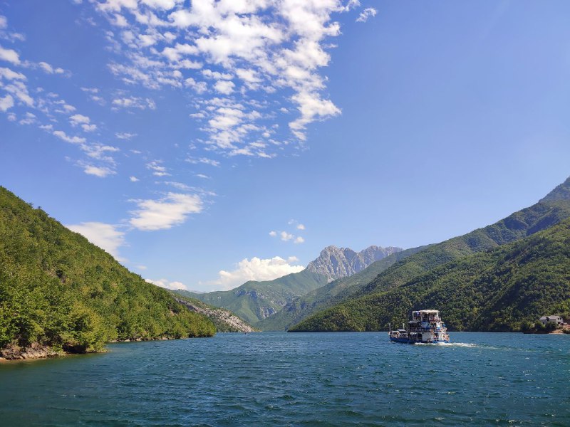
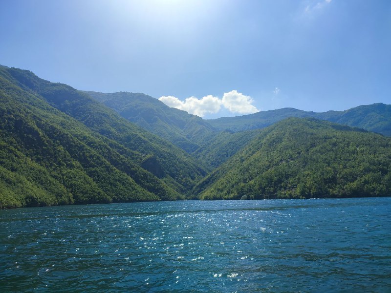
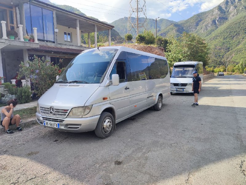
(translation pending)
(translation pending)

There are tons of fields in Serbia. They look really photogenic. I even caught the edge of a rain shower, so as a bonus I got a double rainbow.
Just need to wait a bit for the sunflowers to grow. And find a big field with them. That should look amazing too.
Just need to wait a bit for the sunflowers to grow. And find a big field with them. That should look amazing too.
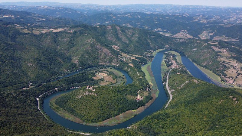
Serbia's terrain is quite hilly. So when you drive even slightly off the highway, you immediately run into all sorts of winding mountain roads. But from a drone, it looks really beautiful.
The video shows a fairly large village, but you shouldn't attribute its excellent condition just to its size. Even in small settlements, you rarely see houses falling apart or looking really poor. Well, except for the abandoned ones.
You can see that people invest in their homes without sparing any expense. From up high it might not be that obvious, but on the ground it really stands out.
We got dumped with snow. Flew over the neighboring forest — it's beautiful all around (watch with sound :) ).
And here are some photos from mountainous Ingushetia.
Mountain Ingushetia is amazing! Mountains, tower complexes, nature—it's all absolutely incredible. I'll post pictures later.
But there was a small catch thanks to border guards and some weird laws. Turns out you can't fly a drone within a 5 km zone near the border without special permission (honestly, I still don't get why—enemy satellites get just as good pictures anyway). The border guards kindly let me know this when they happened to drive by while I was launching. We worked it out so I'd stop flying and they'd go on their way. There was also the option of me riding along with them to file a report, but neither of us were really into that idea.
But there was a small catch thanks to border guards and some weird laws. Turns out you can't fly a drone within a 5 km zone near the border without special permission (honestly, I still don't get why—enemy satellites get just as good pictures anyway). The border guards kindly let me know this when they happened to drive by while I was launching. We worked it out so I'd stop flying and they'd go on their way. There was also the option of me riding along with them to file a report, but neither of us were really into that idea.
There are lots of small villages in the mountainous regions of Ossetia. In most of the tiniest ones, there are practically no permanent residents left—urbanization is spreading across the planet. But wherever people do stay, yellow gas pipelines are everywhere (look carefully at the end of the video). Even for just 1-2 people. At least around popular spots, I kept running into these utilities all the time. Hopefully, connecting to the pipeline doesn't cost a fortune for the locals.
P.S. Telegram really crushed the video quality last time. I'll try uploading with a slightly larger file size.
P.S. Telegram really crushed the video quality last time. I'll try uploading with a slightly larger file size.
The mountains are beautiful! (and no internet)
►
Forwarded from Perito | Медиа о культуре и территориях
Right now, Tanzania is one of the few countries that's actually open and worth visiting. And it's not just about Zanzibar—on the mainland, you'll find national parks, safaris, and tribal communities. Sure, planning a trip like this can be a headache sometimes. That's exactly what our massive guide is all about: how to plan it so everything goes smoothly and what to see!
https://perito-burrito.com/posts/tanzania-guide
https://perito-burrito.com/posts/tanzania-guide
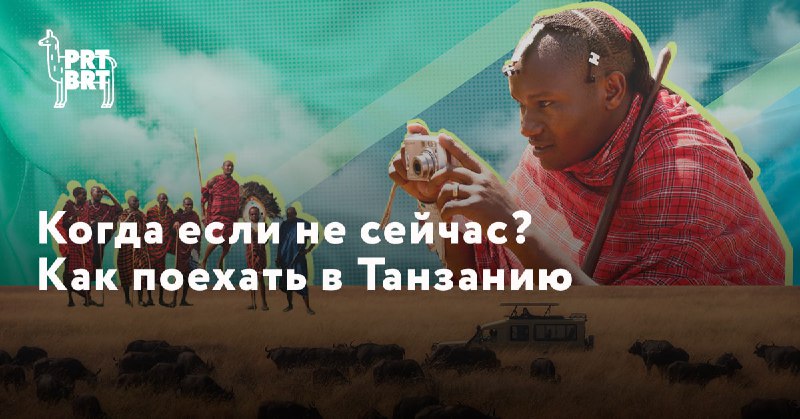
Hooray! My big (really big) guide on how to prepare for a trip to Tanzania just came out on the amazing Perito Burrito. If you're thinking about going, definitely give it a read :)
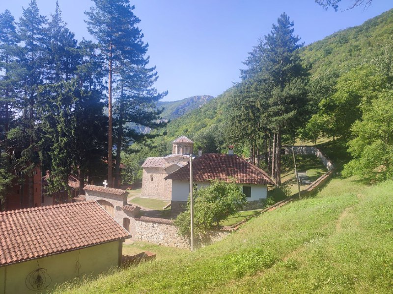
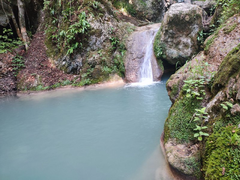
Since I happened to be near Sergiyev Posad, I decided to check out Gremyachy Waterfall too. From the descriptions, it looked really intriguing. In reality, it's not worth making a special trip out there. But if you're passing by, you can definitely stop in.
The wooden buildings are relatively new. About 20 years old. Although, the main temple actually burned down this year. They're planning to rebuild it.
The last 1.5 kilometers of road to the place is an absolute nightmare — terrible dirt road. I managed to get through in my sedan, but only because there hadn't been any rain. Just before the turn, there was a nice sign about the governor's paved roads program :)
In descriptions of the waterfall, they write "the highest waterfall in the Moscow region," "a quick alternative to Caucasus waterfalls." In reality, it's much more modest, though crowds of pilgrims do fill bottles with water from it. And they even argue about which stream has the most healing properties.
More animals :)
We weren't too lucky with the weather – in some places the road was completely washed out, and we couldn't reach the best spots for lions or get closer to the rhinos because there was a river where the road should have been due to the rains.
This kind of weather is unusual for January-February. It's supposed to be dry season, but something went wrong.
Countries
 United Kingdom3
 Serbia100
 Bosnia and Herzegovina54
 Turkey42
 United Arab Emirates3
 Brunei2
 Indonesia12
 Malaysia15
 Argentina16
 USA117
 Morocco5
 Georgia5
 Egypt16
 Hong Kong8
 China4
 Vietnam9
 Tunisia7
 Montenegro9
 Philippines12
 Singapore10
 Oman12
 Algeria12
 North Macedonia5
 Lebanon11
 Israel27
 Albania17
 Russia63
 Tanzania50
 Netherlands7
 Spain14
 Latvia2
 Germany7
 Belgium3
 France27
 Kazakhstan32